After some initial success with multipitch climbing, Trevor and I set out to get more practice out in Tahquitz. The best part of this crag is its abundant and high quality moderate routes – and by moderate I really mean the easiest it gets. As true beginners we set out on trying to climb the remaining two routes rated 5.4, starting with White Maiden’s Walkway. This was the benchmark 5.1 in the original list of climbing grades for Tahquitz and navigated its way through the easiest path up the center (Maiden) buttress of the spire. Although it was rated 5.4 it was a step up from our first climb on the Trough, which was shorter and technically easier. Plus WMW had a psychological crux on pitch 4 – an exposed section called the ‘doubtful corner’ which required a committing step over to a ledge without any great handholds. Little did we know at the time the real crux would be route finding along the ~800 ft buttress, which had plenty of good looking sections that climbed much harder than 5.4. Despite this, we both thought this was a great next objective and were pumped to make it back to Tahquitz for our third multipitch climb.
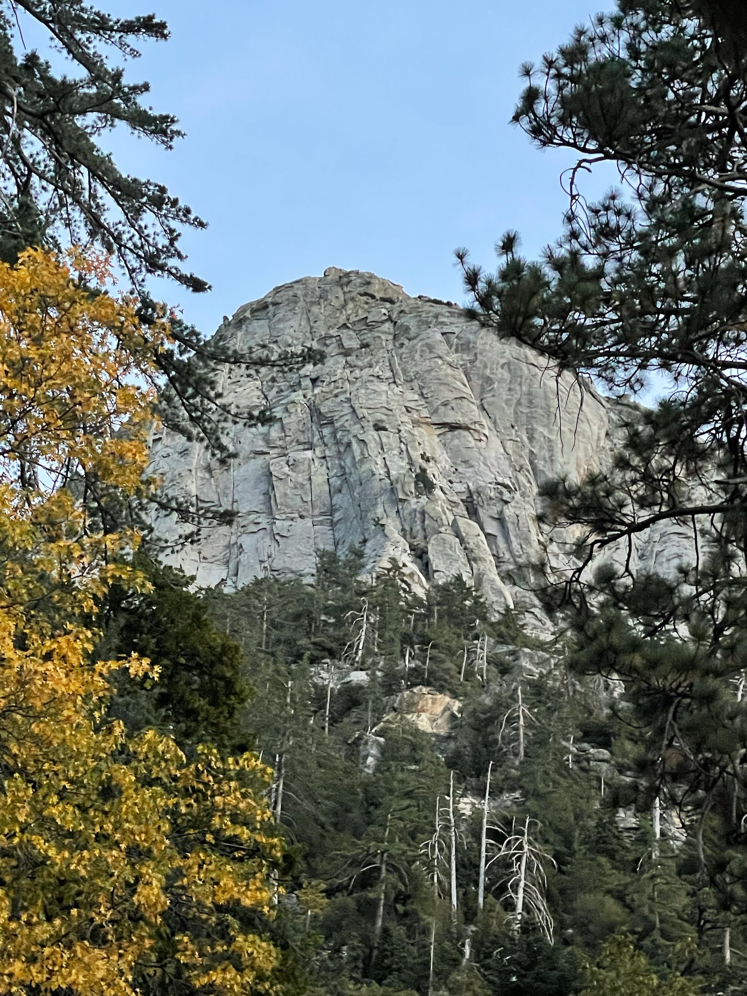
Tahquitz rock in fall colors ❤
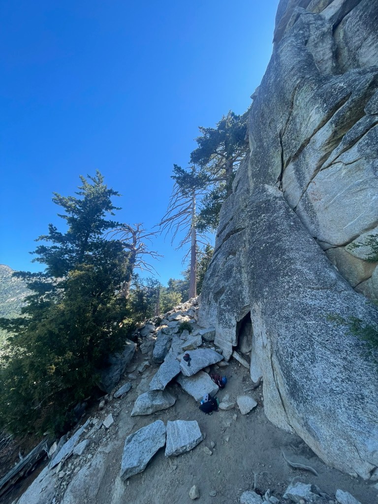
On the drive over, Trevor and I scrubbed all beta that we could on WMW through mountain project, the local guidebook, trip reports, and videos online. Despite there being a ton of information, there was no clear consensus on where this climb even started. Of the topo’s listed in mountain project, two of them showed different entrances and one was described as having a couple 5.6 moves. But soon we were at the trailhead and figured it would be more clear at the base of the rock. The trail felt quicker this time, even though its always pretty steep and long. After lunch rock, we traversed over to the Maiden Buttress and saw another group at what looked like the start of the route. We were pretty certain this was the 5.6 entrance and heard that the group in front of us were aiming to take a slightly more direct variation of WMW rated at 5.7. We figured it would be nice to have a group to follow for the most part and got setup at the base. Trevor began the first block, with the idea that I would take over the lead for pitches 3&4 (the cruxes) while Trevor got some practice on 1&2. Despite the first pitch overall being super easy climbing, the initial 5.6 moves were pretty difficult and committing. There were no real handholds and two small foot placements high up requiring an awkward mantle right off the deck. Trevor made it past this section and sped up to the first ledge pretty quickly – a great lead.
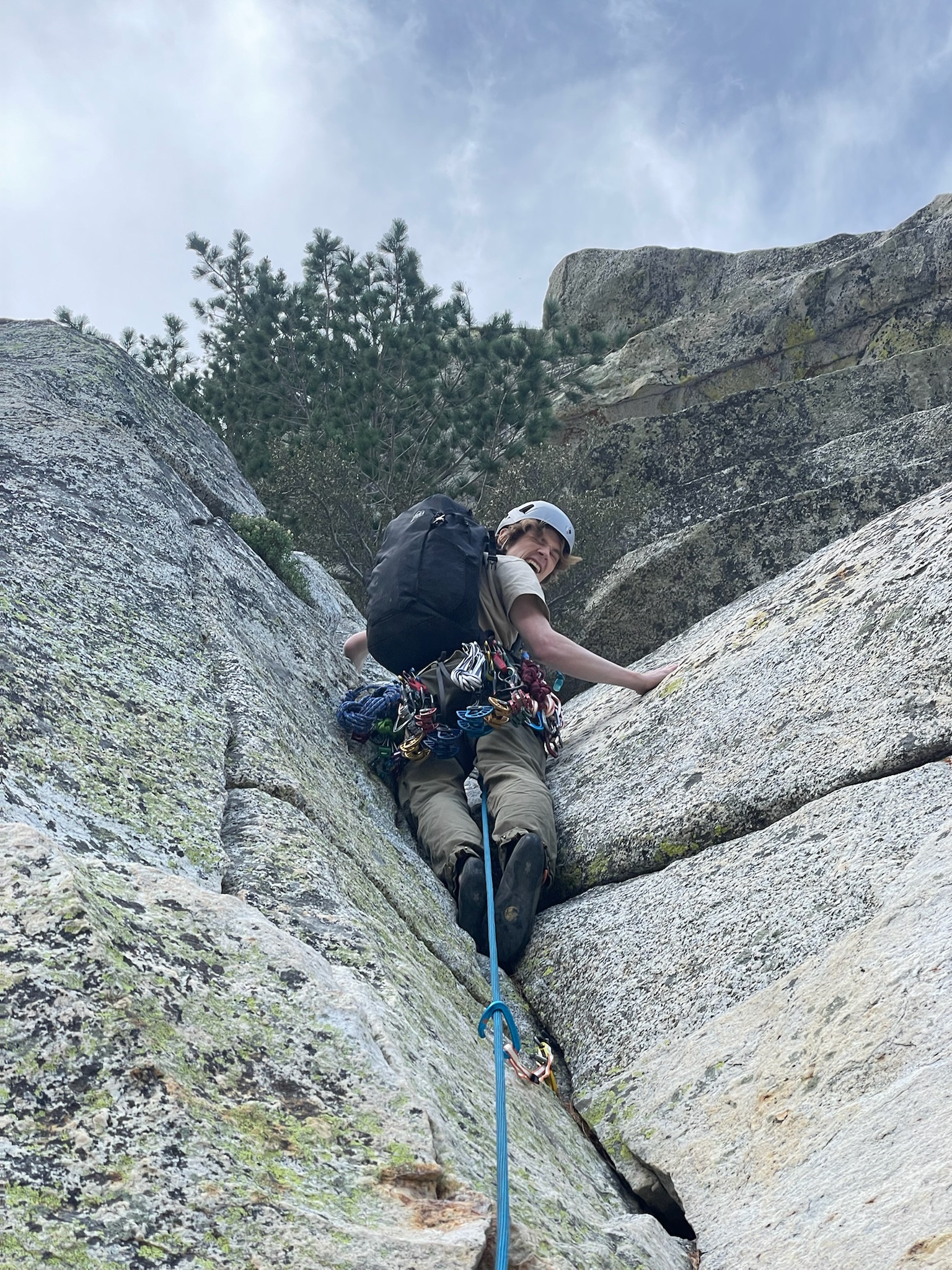
Trevor making it past the 5.6 moves from the deck of WMW – a great lead
Next up was pitch 2, a similarly moderate pitch with one step over section that seemed a bit cruxy from the topo. Trevor began onwards and quickly made it out of my sight. But after this point things got a bit tricky and I began to wait it out at the belay. Soon after another group joined us, a couple with a newer follower who wound up being great belay companions. While we waited there, it was clear that there were some route finding issues ahead. Trevor was not confident where the step over was and became pretty intimidated by the more direct 5.7 route that seemed like the more obvious path ahead. To add to this, a single cam placed at the start at the route combined with the step over lead to a high amount of rope drag. A little over an hour passed and Trevor made it to the end of pitch 2 at another big rock ledge. At this point I was getting pretty nervous for the remaining leads and did a pretty poor job at following the line. When I finally got to the belay, I was not feeling good about the next pitch and I knew Trevor got a bit spooked from the previous lead. Given the time of day, uncertainty in the route, and general bad vibes, I made the call to bail for real and come back another time. Luckily for us, the group behind us also decided to bail (hopefully not from our influence) and had left a great bail anchor at pitch 1. We rapped down and only had one issue with ropes getting caught in bushes that unfortunately required some solo-ing to retrieve. Despite the failed effort, I felt really good about our decisions that day (sans the rope retrieval). It was important to me to recognize when to bail and to follow through with bad feelings in consequential terrain. Our ego’s took a hit not finishing a truly beginner route, but who cares? Really it just gave us motivation to get it the next time and saved us from a long day or potential epic.
Second repell from our first attempt bail on White Maiden’s Walkway
And before we knew it, Trevor and I were back at Tahquitz a few months later. This time we both did a lot more research on route finding and even drew a notebook topo to help memorize the line. I had been climbing a lot more too and felt generally more confident that we could pull it off this go around. We arrived early at the trailhead after buying some small cams at the local shop and blitzed up the approach. We planned the same lead block strategy and Trevor sped back up pitch 1 to the belay station. When we arrived, we let another group pass ahead of us, figuring that it would be nice to follow for the remaining pitches and ensure we had the best chance at good route finding. Despite loosing a bit of time while this group passed, pitch 2 felt way better than before. I found the step over and it felt super clean all the way up to the belay. The group ahead of us lead on to pitch 3, and we hung out for a little bit on the large rock platform. I felt ready for the next two steeper pitches, but was still pretty nervous for what was ahead.
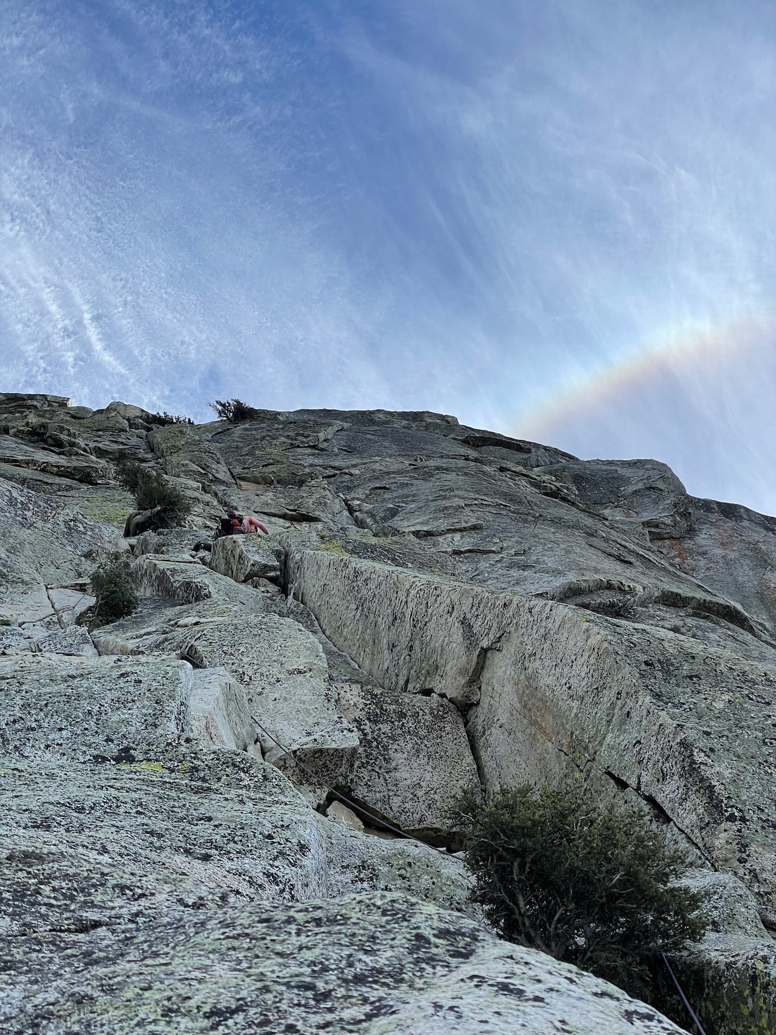
View from the top of pitch 2, A rainbow looming above White Maiden’s Walkway
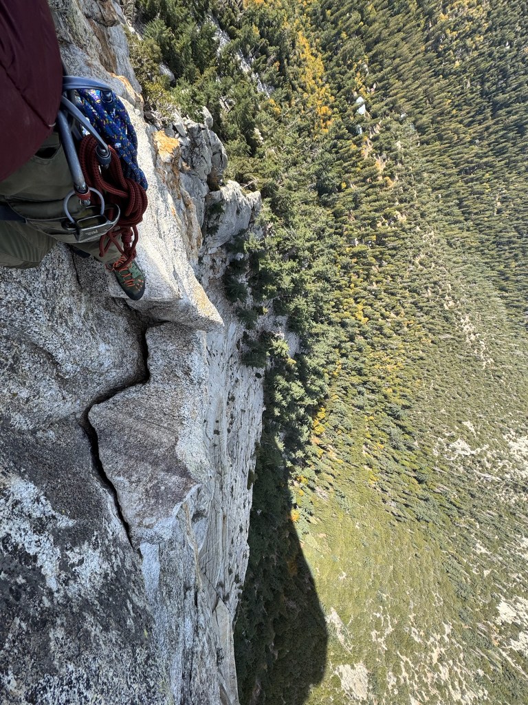
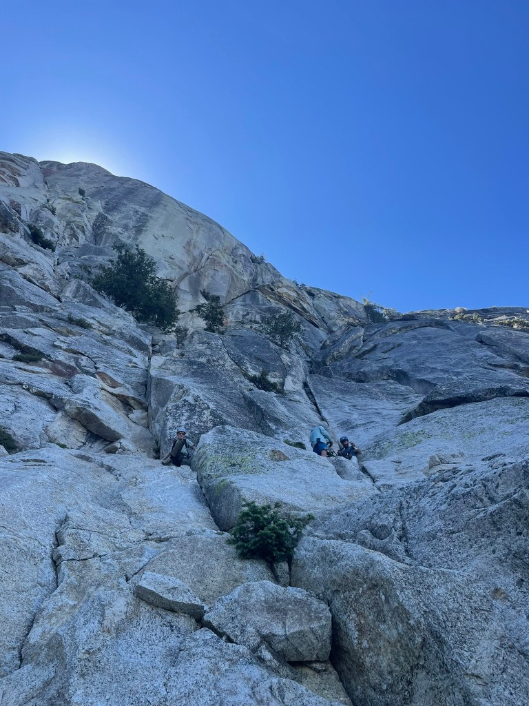
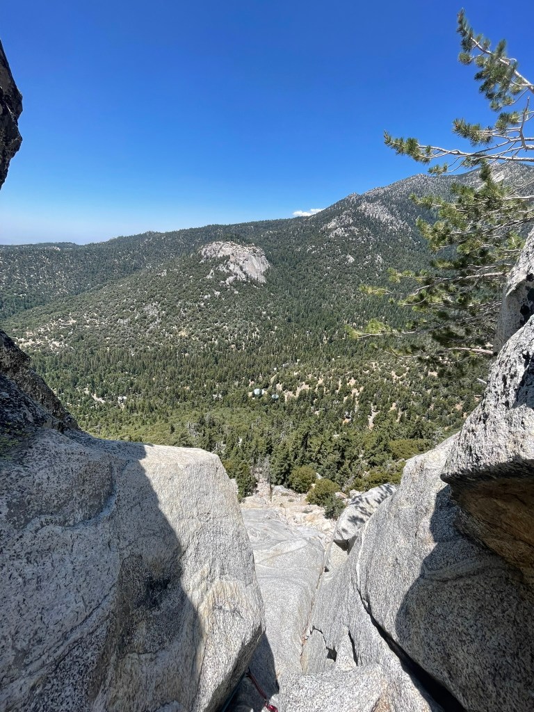
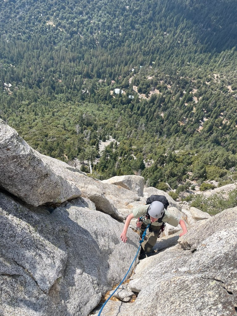
Turns out I had nothing to worry about, pitch 3 was spectacular. There were great placements for gear and good handholds despite a relatively steep slope and way more exposure than before. Near the end there was a mini exposed corner with a hidden glory jug that made for a great finish. The belay at the top was bushy and crowded with the next group, but I was glad to get a breather before the doubtful corner looming on pitch 4. Trevor sped up and after a few minutes of waiting we were ready to rip again. The pitch started off with a protected chimney that progressively became narrower until it ended at a tiny ledge. After this point, there was a single crack for a blue C4 cam and no more hand holds. Instead the ledge rounded a corner and required an exposed step over to another large ledge incut about 2 feet into the slope. The step over itself looms over the base of the route about 300 feet below. I stood over the edge patentiently and calmed myself down. Next I carefully placed my right foot at the left most point of the ledge, allowing my left foot to slowly round the corner and find a smear on the wall across. There were no real handholds, so I carefully lowered by left hand until I had one or two fingers at the next ledge. As soon as I leaned over enough to feel secure I committed to the move and it went as smooth as it could have. I pulled myself up past a tree on the same ledge and took a huge sigh of relief. Standing there was one of the coolest moments I’ve had climbing. It was a moment of pure flow where I met and executed a challenge I felt matched my ability at the time. I looked down at the exposure and the view of San Jacinto ahead feeling on top of the world and pumped to finish the rest of the climb. The last bit of pitch 4 was effecitvely fourth class and a good fun. Trevor followed and made it through the corner with no problems – having used the tree on the ledge for some additional support.
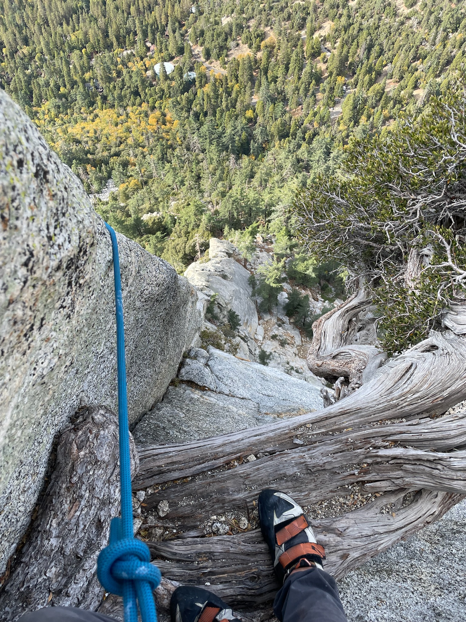
Trevor’s view immediately before the doubtful cornerThe view after stepping over the ‘doubtful corner’
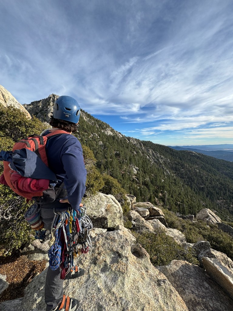
I lead pitch 5 and followed closely to the group ahead of us. Most of the route was super easy except for the final ledge which traversed to the right of the summit. I chose to wrap around the ledges and up some juggy handholds, which felt easy but had poor pro and high exposure. I managed to place a small cam anyway and mantled up the final ledge and onto some low angled slopes to the finish. At this point I had expected one more pitch and was surpised we had managed to link some of the last few pitches together. This led to a great surpise for Trevor as he followed up the last pitch and up the the belay. I was incredibly pysched to had made it to the top given our previous bail and the clear step up in difficulty for this route. Not only that, but I had felt our climb was the smoothest we had done yet on both ends. Trevor’s P1&2 leads were way faster than previously and I did not feel overly uncomfortable at any point along the climb. The doubtful corner is a super cool lead and the whole route is definitely a classic moderate of the crag. The way down on the friction pitch went smoothy and we spent the whole time discussing where and how much pizza we were about to consume. Overall this experience made me much more confident in progressing in traditional multipitch climbing and stoked to continue progressing with more climbing in the future.
Top out viewA beautiful sunset over San Jacinto on the descent
The inspiration for the Grand Teton is a funny story in itself. Trevor brought it up first after some mountaineering type trips in Colorado and Mt. Baldy, but before then I had no idea what climbing it would involve. I also had no idea what outdoor climbing in general involved outside of some top roping here and there. But inspiration is a funny thing, having such a clear vision of a goal yet having no idea what is involved in its pursuit made us pretty damn motivated to try and figure it out. And to start I pulled up Mountain Project for probably the first time in my life. I had climbed a few times before in a gym and outside, but never did much above 5.10 ish top roping or low grade boulders. The easiest way up the Grand was the Owen Spalding route, rated at 5.4 – which seemed incredibly easy at a first glance. It wasn’t until I started really researching that I began to understand the reality of traditional climbing ethics and that 3000 ft of exposure in bad weather can be pretty terrifying. But here we were, two kids with a spike in motivation and maybe 6 months before the timing was right. In that time, all we had to do was learn to lead climb, learn to make anchors and place gear, get in shape, and then go for it!
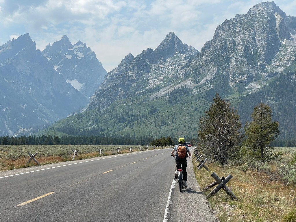
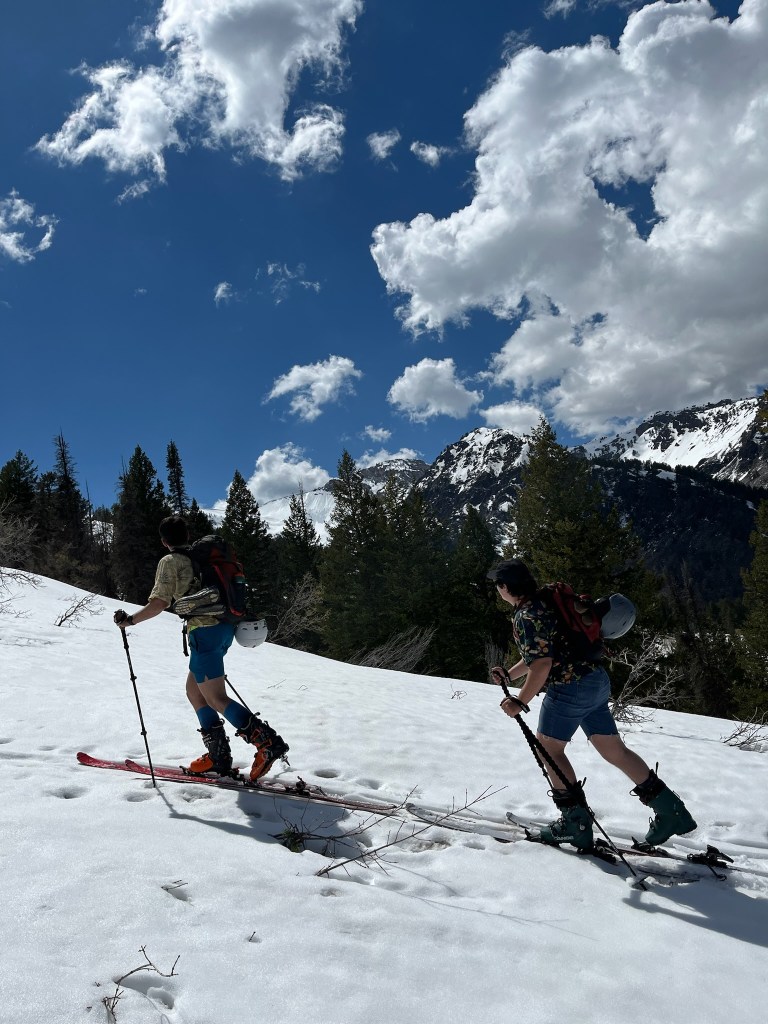
Trevor and I e-biking through the spectacular Grand Loop trail
Trevor was the initiator of the idea to climb the grand and had booked a week off to travel in the Tetons for late July. At the time it was still early spring and we mapped out some intermediate milestones necessary to build up technical skills and experience. A majority of the climbing preparation is described within the “SoCal Climbing” post from earlier this year (https://maxhalk.com/2025/05/25/how-to-not-fall-socal-climbing/). But the TL;DR is that a lot of preparation went into this objective. The general strategy was to learn technical skills in a comfortable setting and then take our skills outside to practice. Doing this helped instill confidence that we could tackle similarly difficult technical terrain but with weather, exposure, and pressure in the mix. First we practiced some strenuous and exposed terrain first like Mt. San Antonio’s headwall chutes and Mt. Hood’s old chute / south headwall. Then we moved onto a lead climbing course at our local gym along with some outdoor practice at Malibu Creek for our first sport climbing experience. And finally we took a two day anchor, rescue, and trad gear placement course in Stoney point ahead of our first multipitch lead at Tahquitz. We paced each activity out over several weekends and tried to get reps in the climbing gym during the weekdays. I personally was still feeling the nerves about my overall climbing ability and ropes skills, but slowly felt better through a few months of ~2-3 climbing sessions a week. Then after our first multipitch climbing experience went well, I knew we at least stood a solid chance at making it to the summit. The nerves would still linger, but I could trust we had practiced the right skills and could lean on our experience when it was our time to shine.
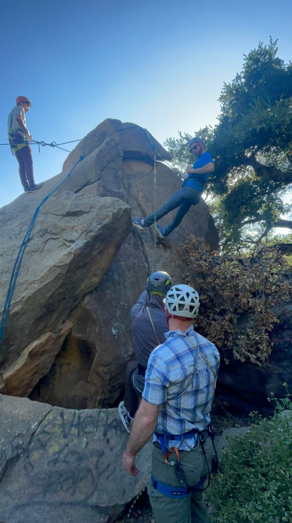
Rappel practice after our first outdoor lead in Malibu Creek
When we first committed to climbing the Grand in the early spring of 2024, July seemed plenty far away to avoid thinking about it in earnest. But before I knew it, I was on a flight to Jackson and glancing at its striking summit within the broader Cathedral group. There is something special about the surrounding area – the mountains rise dramatically from its peaceful valley and the alpine environment is defined by massive and sharp granite peaks. People come from all across the continent to climb and ski in the Grand Teton National Park, where its namesake peak stands as a right of passage in many ways for the local community. While descending the Ford-Stettner couloir or completing the ‘picnic’ is probably out of my league for the next couple years, these traditions are part of the inspiration for making the journey out to climb this mountain and acquiring the skills necessary for an attempt in good style. After landing mid-week, I met Trevor and his dad after they had made it back from hiking in Death Canyon. We would stay in the Jackson Hole resort hostel for the next couple days, giving us a ~2 day window to camp at the Grand Teton’s lower saddle and make some summit attempts. For now we ate in town, visited the local mountaineering shop for last minute gear, and meticulously researched beta on the route (mostly through https://wyomingwhiskey.blogspot.com/). The next morning we would wake up and drive to the trailhead, starting our journey towards our basecamp.
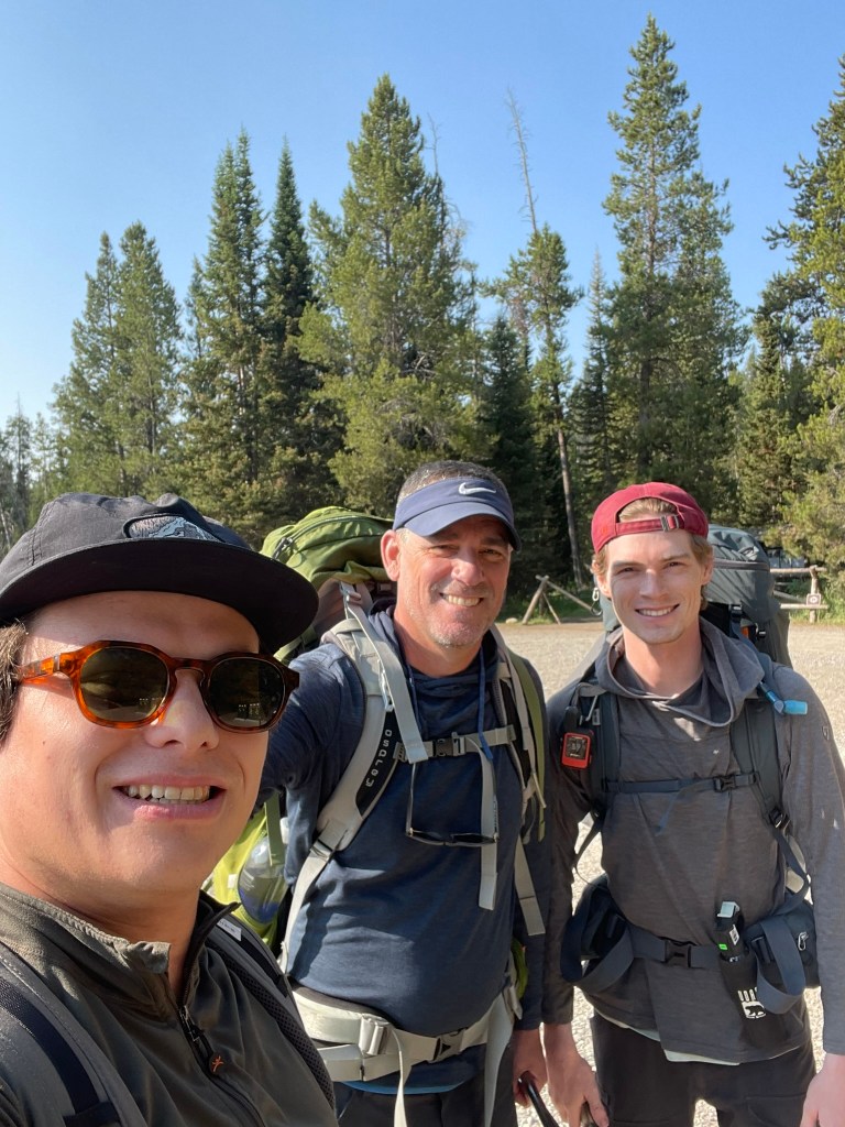
Trevor, his dad, and myself at Lupine Meadows Trailhead
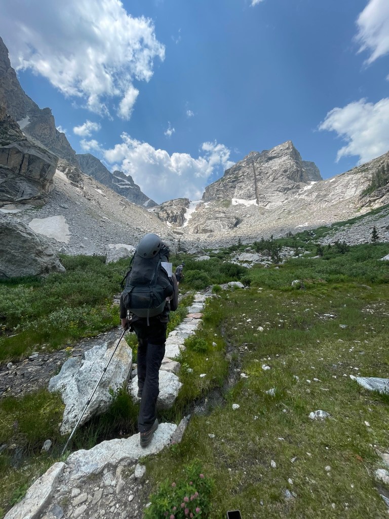
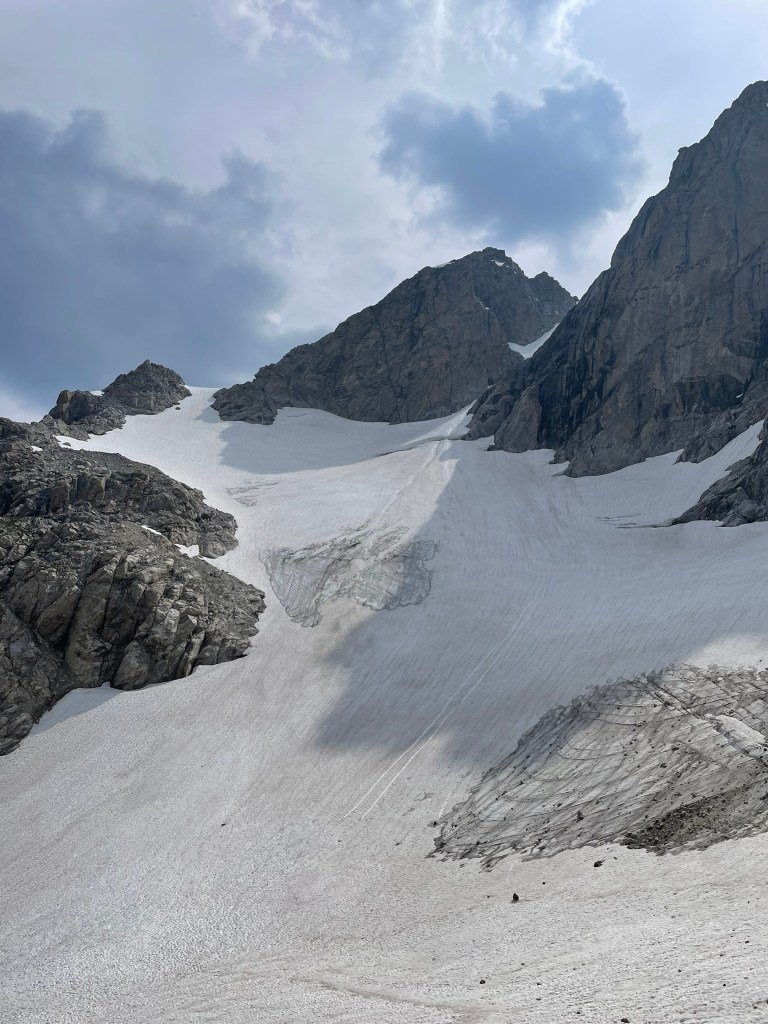
Trevor, his dad, and myself arrived at the Lupine Meadows Trailhead around 9am and were gifted with some beautiful weather. Our packs were heavy and filled with overnight gear, a rack & a half of gear, and a 60 m rope. The first ~2.5 miles of the trail felt smooth as we navigated a well maintained path and several switchbacks into Garnett Canyon. As soon as we rounded the corner into the canyon we got our first few of the huge granite walls cut by glaciers which loomed below the Grand’s north valley. Below us were a handful of lakes that accompanied the larger Jackson valley and made for a fantastic viewpoint. Not long after we made it to the first milestone of the hike: the platforms campsite. Here was the start of the alpine meadows of Garnett canyon and where Trevor’s dad would stay the night. We took a quick lunch and took in the views before our journey continued up the bolder fields ahead. We also were able to fill up completely on water from the river splitting through the canyon, a huge perk of the trip that would continue until our camp at the lower saddle. Trevor’s dad stayed back at this campsite where he would wait for us to get back from the summit and give us some peace of mind that help was close if we needed it. Ahead of us was still about 2500 ft of elevation gain across two rock bands before our campsite. We started off again and were immediately met with a beautiful alpine meadow perched right below the middle teton’s imposing east face. In all directions were huge granite walls carved by extinct glaciers that once inhabited this canyon. Soon we found ourselves on a slog of steep switchbacks which lined these walls ahead of us. The trail quickly became less and less friendly as we started to hop over large moraine fields and up looser talus slopes between sections of trail. Once we made it over the first rock band, the landscape changed dramatically into a seemly barron wasteland of rock and ice. It was incredible to witness and soon enough we could just make out the Grand Teton’s massive exum ridge as we passed to the north fork of Garnett Canyon proper.
Trevor and I making our way through an alpine meadow below the Middle TetonLooking toward the Middle Teton glacier, which had some ski descents in August after our climb
The last stretch of trail before we arrived at the lower saddle for camp was the 2nd rock band. It was a similar slog of talus and switchbacks to the first, but also had a section of steeper rock forming a headwall. Luckily there was a maintained fixed rope, which helped us haul our heavy overnight packs without fear of soloing or pulling out our technical gear. At this point I was getting pretty tired, but knew we were making great pace for setting up camp in the light and heading to bed early. When we arrived, we were greeted with many other groups setting up camp across the massive saddle between the Middle and Grand Teton. There was a large and semi permanent tent at the top of the saddle and occupied by a fairly large guide group. Nextdoor was a small wooden outhouse with one of the best toilet views you could ask for: the entire western drainage of the Teton range. Our campsite was shielded by a massive boulder and sat closer to the eastern side of the saddle. Trevor and I quickly put up our tent and made some camp meals before sun set. I had saved the wyoming whiskey webpage for beta and was reviewing our route to the Upper Saddle and Owen-Spalding ahead one last time. We were about to sleep at nearly 12,000 ft, so we quickly got ready for bed and prepared for some mediocre sleep before our 4 am alarm. The plan for the next day would be to summit, pack up camp, and then make it all the way back down to the trailhead – a truly huge day for us.
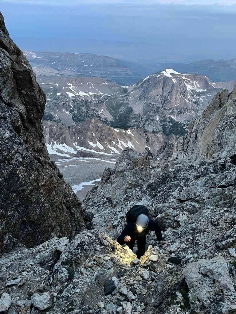
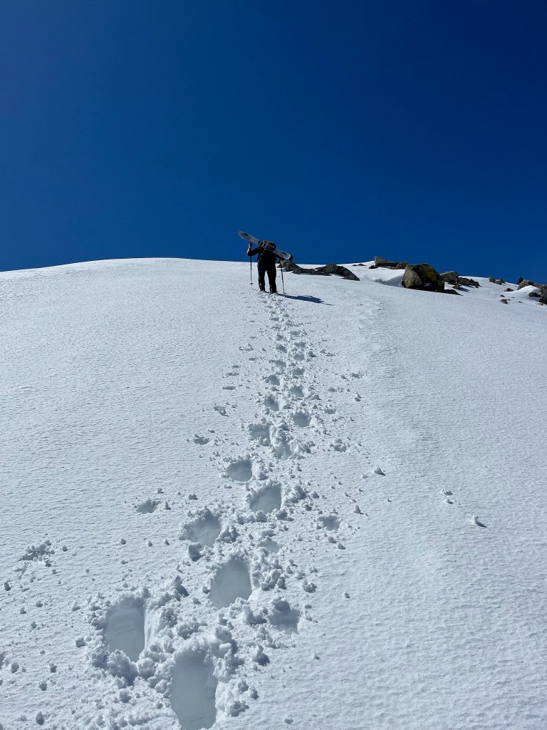
Trevor scrambling towards the Upper Saddle at dawn
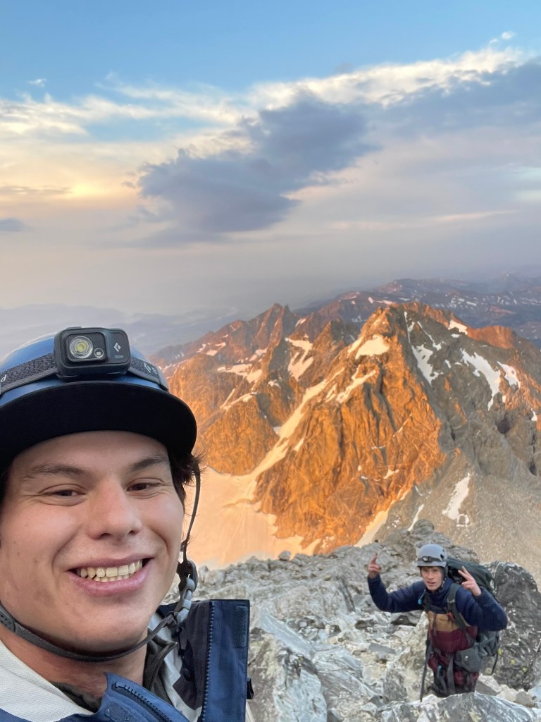
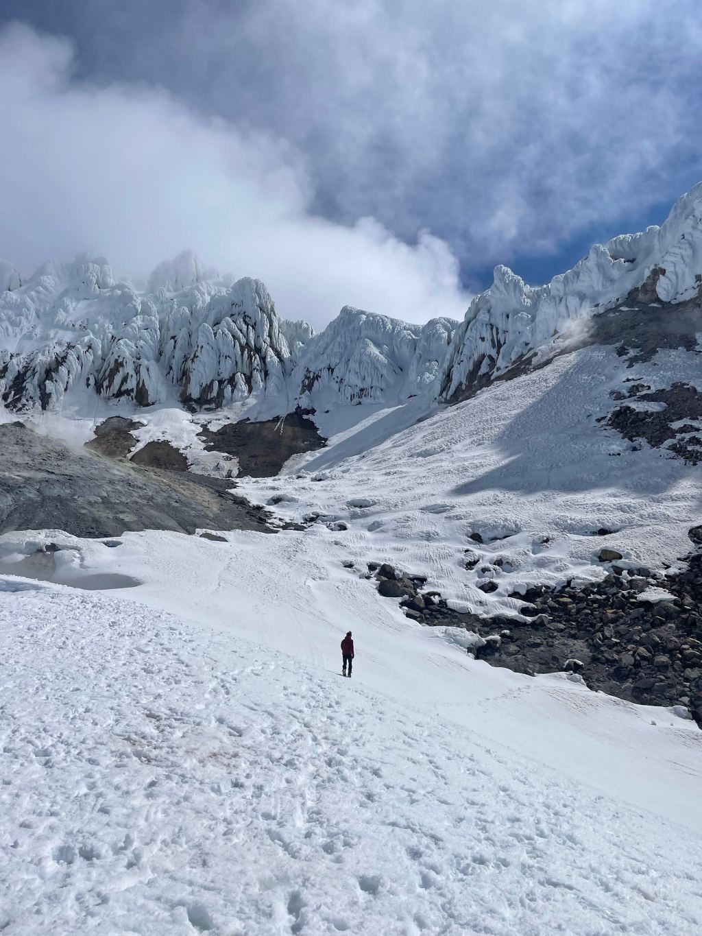
Sleeping was difficult, I got brief moments of true rest interspersed with many more moments of uncomfortable churning. Getting out of the tent at 4 in the morning was rough, but both Trevor and I got to work with final packing and making breakfast. We shared a bowl of oatmeal and then made our way towards the gradually steepening trail headed to the Upper Saddle. The route ahead was about 500 ft of talus and 1000 ft of ~4th class scrambling before the roped climbing even started. Route finding was the crux here and we both put in a ton of time researching our way. First up was the chockstone chimney, a ~50 ft section of exposed scrambling with pretty loose rock. This went by quickly and we found ourselves making it through the next couple of obstacles without much trouble. Climbing through the ‘eye of the needle’ was a highlight as we navigated our way through a natural cave / tunnel feature in order to avoid the more precarious ‘Briggs Slabs’ on our left. We also met some climbers on their way to the Upper Exum route and point them towards ‘Wall Street’ – a crazy exposed ramp that connects the scramble to the prominent Exum ridge. After this point the sun started to rise and we were gifted with a glorious orange glow to light up the range behind us. The Upper Saddle was in sight, but we took a moment to bask in the view behind us as it was the highlight of the trip so far in my eyes.
Trevor and I basking in the alpenglow and looking south towards the Middle Teton
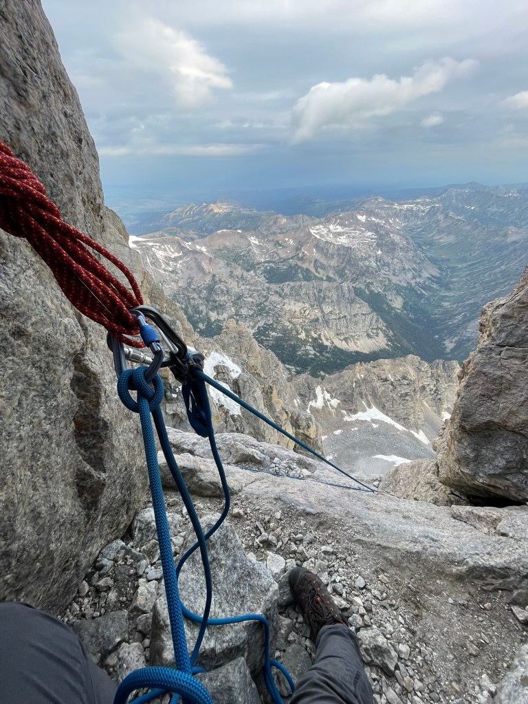
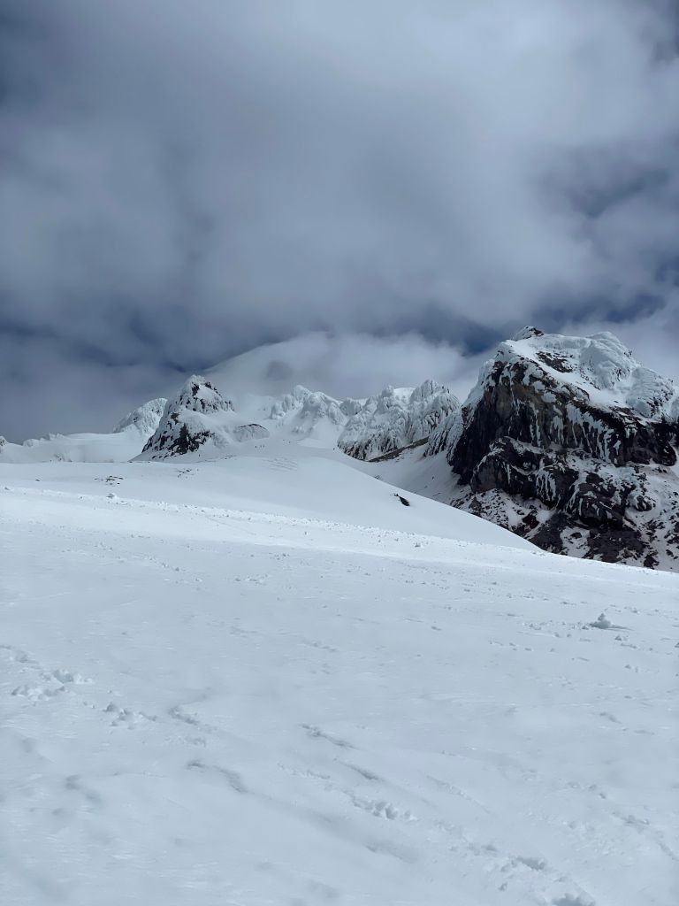
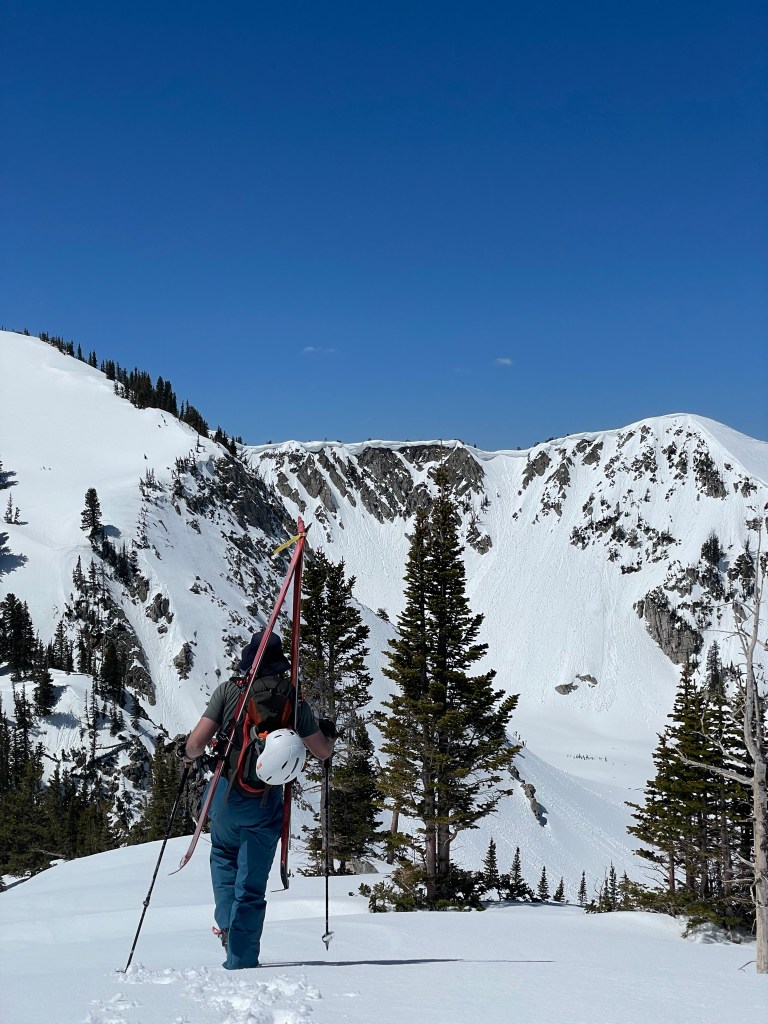
In contrast to the incredible alpenglow, we arrived at the Upper Saddle and were quickly greeted with the Grand Teton’s intimidating West Face. This second saddle marked the beginning of the Owen-Spalding route and rapidly dropped off on either side straight to the valley floor below. We sat there with two other groups and discussed the plan ahead. While the weather at that moment was calm, we knew there were clouds quickly approaching. We expected this storm to come and bring rain, but really we were afraid of any potential lightning. We had an updated forecast from inReach messaging Trevor’s dad in the morning and knew that lightning was a potential after about noon in the day. We had a solid 4 hours ish of time to get down from the summit, which was enough margin as long as we didn’t get stuck up there for some reason. At this point we had a decision to make and I was feeling pretty scarred to commit. I knew that it possible and that Trevor and I’s training to this point has us well prepared. So at that point I took charge and committed to the route by starting to build our first anchor. We decided to add one more pitch to be protected while making it past a traverse to the start of the climb. This section had easy climbing but made it’s way past the saddle and over about 2500 ft of exposure to the valley floor below. The belly roll and the crawl were two incredible features where you could hold onto jugs and smear your feet over an insane and terrifying setting. Shortly after I found myself at the 2nd entrance of the route and below an obvious belay ledge. I placed one final cam and up a sketchy off width crack before making the anchor.
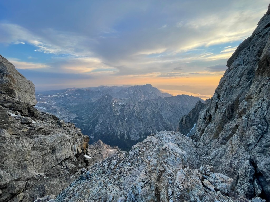
The view north at the Upper Saddle
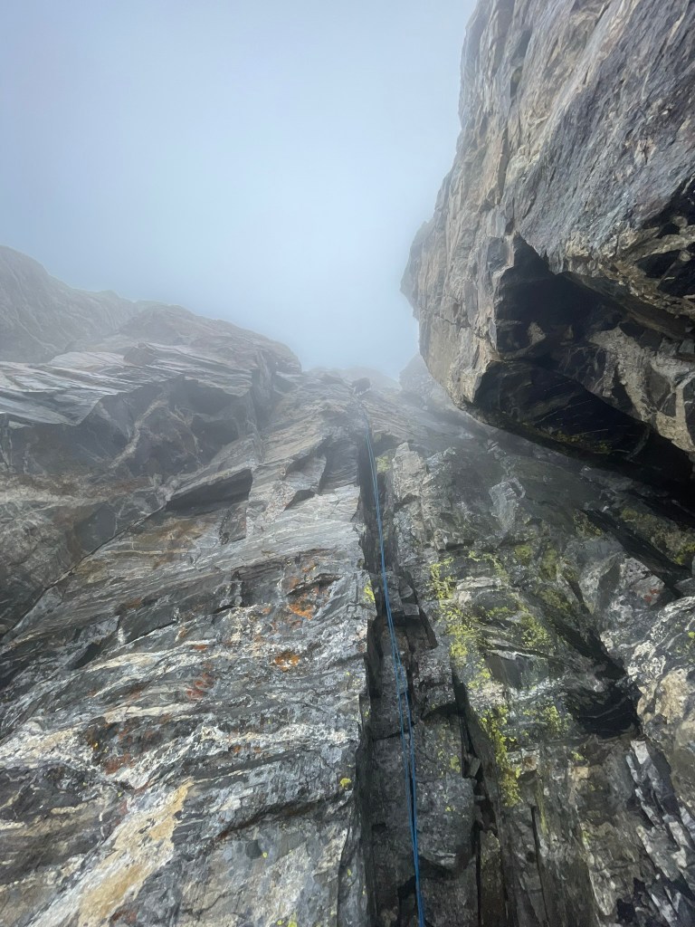
At this point the weather was slowly starting to get worse and Trevor was making his way through the first pitch. Our lack of radios made communication hilariously difficult for a traverse pitch, but luckily he understood my plethora of rope tugs as a sign that he was on belay. Next a free solo-ist passed us and tugged on our rope during the sketchy off width section. Then Trevor arrived and I started up the next pitch. At this point I was having a blast and was completely in the flow state. Climbing was not very difficult and the worst of the exposure was passed us. Pitch two had another natural tunnel and I was able to run out the majority of the climbing. Soon enough we reached the Owen chimney to mark the start of the third pitch. I continued to lead to help speed up the day and was feeling great. The weather on the other hand only got worse: there was a lot of wind, the start of rain, and a cloud came in to limit visibility quite a bit. Despite this climbing was still easy and pitch three only had one move that was a bit insecure. Otherwise we made it to the top, traversed over a relatively flat section to Sargent’s chimney, and into the last pitch. This chimney was the easiest so far and I was having a blast. Our timing was still pretty good but I knew we were still chasing the clock to avoid being stuck in worse weather still.
Belaying at the 2nd entrance to Owen-Spalding and looking at the exposure on top of the Upper Saddle
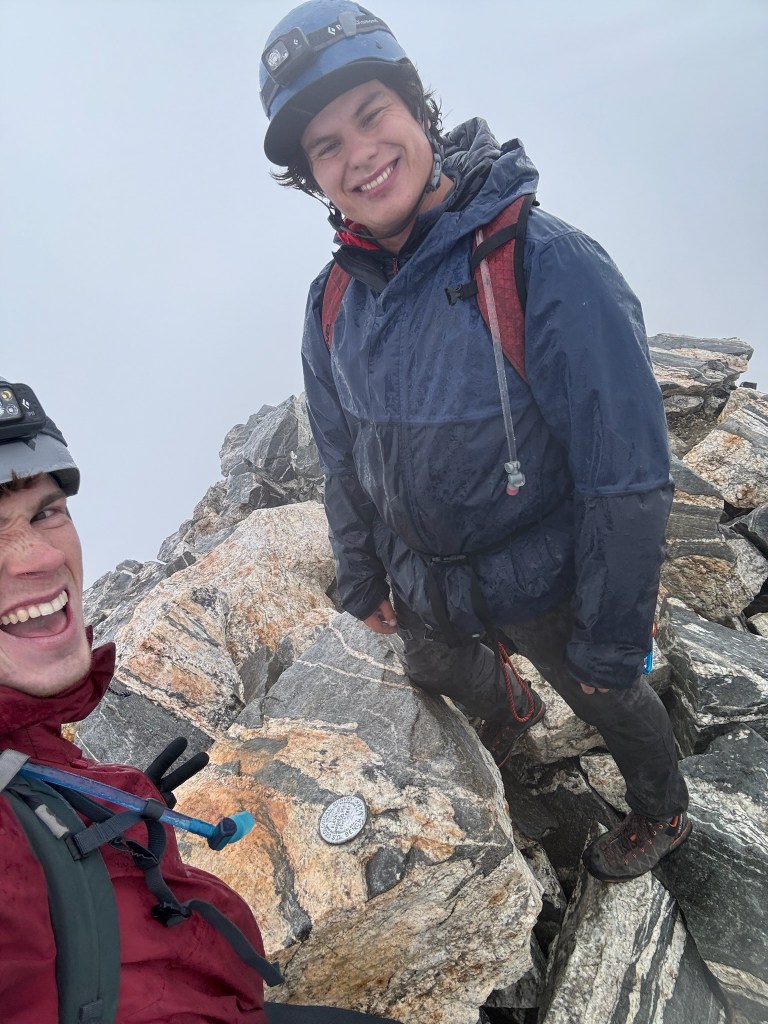
After finishing Sargent’s, we unroped and checked our maps one last time before making our summit push up the last few hundred feet of scrambling. With the clouds fully soaked in we had trouble finding any of the features described in Wyoming Whiskey’s page, so I took the lead and started up what looked like the best path to me. Soon we collided with the top of the Exum Ridge and could see the true summit lingering in the distance. On our right was the imposing east face snowfield, a crazy 50 deg slope where most of the ski descents for the mountain began. Traversing the ridge was a crazy experience, we straddled some sections of knife edge terrain & felt like we were on some crazy remote wasteland while covered in dense fog. Then we finally arrived on the last boulder patch and found the summit marker. At last we had finished the route and achieved this Grand milestone. Both of us were soaked to the bone and still feeling the rush of adrenaline from the climb. We looked around, took some photos of the blank white landscape, and then quickly made our way back to the top of Sargent’s chimney. There was a somewhat maintained anchor here and we made it down without any issue towards the main rappel below. Navigating this ledge section was fairly straightforward and we found a massive and well maintained anchor perched above the large cliff below. We had a 60 meter rope, which required us to stick as far as we could to the looker’s right of the cliff in order to make it to the ledges on the Upper Saddle. I tossed out the rope and heard it whip through the gusts of wind in front of us. On the way down I unsnagged the rope several times and successfully made it to the ledges without much issue.
Mandatory summit selfie and proof that we had no viewTrevor’s descent down the main rappel
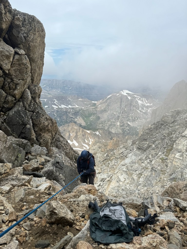
While Trevor followed I began to feel quite cold in the wet and windy conditions. We had finally made it passed the worse of the exposure that day, but still had a massive amount of vertical to hike back down. We ate some snacks and then Trevor managed the descent route finding. This was relatively easy from a technical perspective, but was tedious and Trevor took a minor slip that cut open his hand. Luckily we packed a small first aid kit and we cleaned up the wound quickly. After this and having made it down about 1000 ft from the summit, the clouds opened up and we realised the Grand had its own little whether system which had been plaguing our ascent. Below this layer we could see all the way down to the valley floor and we laughed at how stark of a contrast it presented. Before reaching the Lower Saddle and our camp, we also made a rappel over the chockstone chimney which looked much stepper from above than I had remembered. When we finally made it to camp, I felt relieved but incredibly tired. Trevor graciously cleaned up camp, but I took a quick power nap after feeling pretty mentally drained from the exposure. At this point it was a little after noon and had marked 8 hours from when we left camp in the dark of night. The rest of the trail was about 5500 feet of descent across about 6 miles of terrain. We put on our heavy packs once again and began the last of our journey down towards the trailhead.
My descent down the chockstone chimney
The fixed ropes at the 2nd rock band had a bolted anchor which served as an easy rappel and suddenly we were back to talus fields and steep switchbacks into Garnett Canyon. I was making relatively slow progress and trying to keep up with Trevor on the downhill. Keeping me motivated was Trevor’s dad back at the platforms campsite, where we would get some snacks and renewed energy for the descent below. It took a few hours, but we met up and quickly told the story of our treacherous journey that morning. He was super excited to see us and finally get to head back himself. So we didn’t rest long and continued back on the trail down to the valley. At this point we were passed 12 hours of continuous movement and I was feeling the fatigue. Every second felt longer than usual and the trail seemed to be endless. Really that was just my exhaustion kicking in and the descent was very casual. When we did finally make it back to the trailhead I was simultaneously relieved, excited, and enormously tired. Trevor and I laid on our backs next to the car and below the view of the mountain we had just climbed.
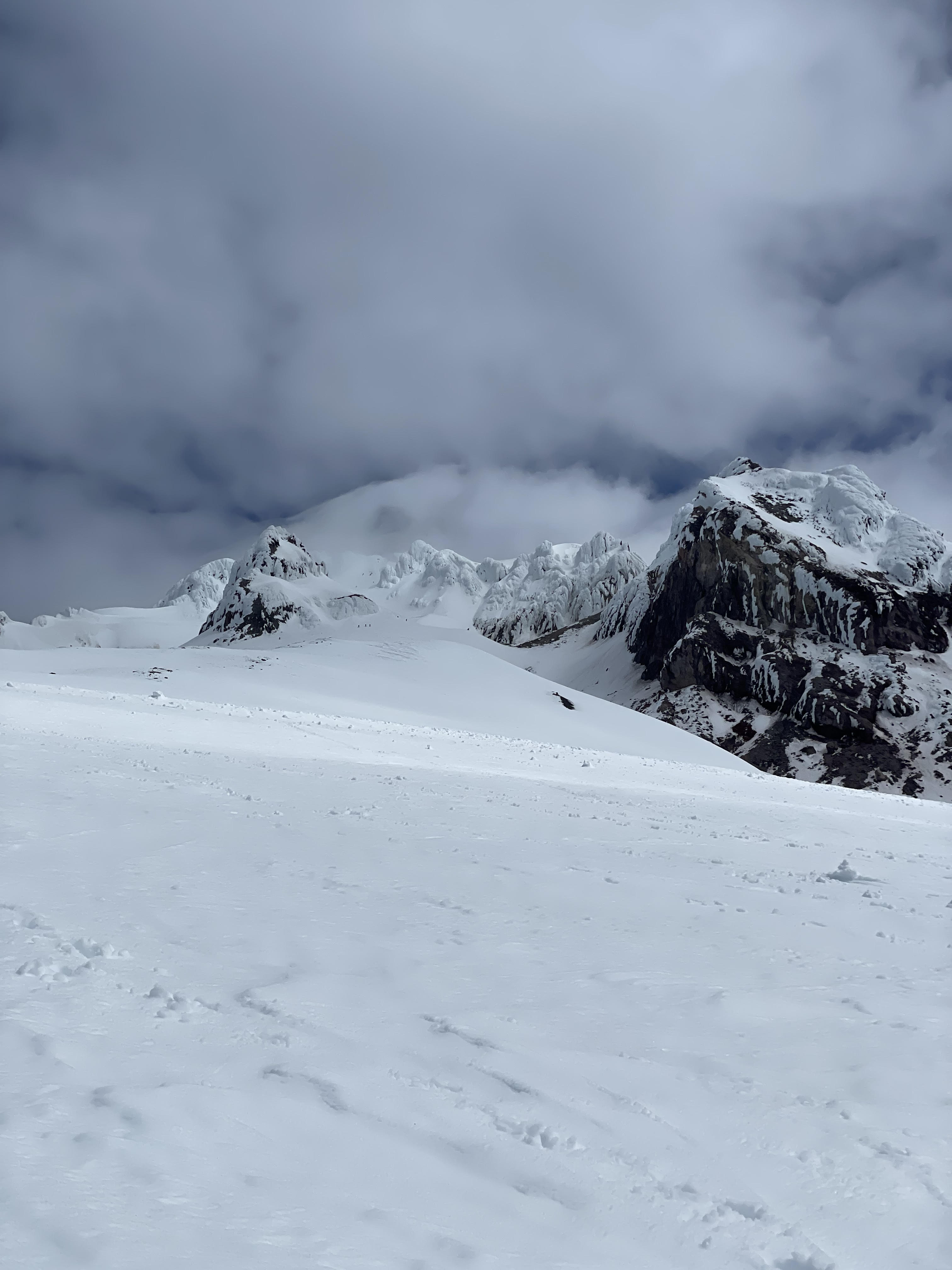
The view of the Grand Teton from the Lower Saddle camp, notice the clouds raining on us only appear on the final 1000 ft or so of the mountain
Later that night, the three of us drove back to our hostel in the Jackson Hole Resort and got some celebratory dinner at the Mangy Moose. We rehashed the day in great excitement and I felt tremendously proud of having finished our mission that began months before. In the coming days we spent some more time in the valley, ultimately e-biking the grand loop and seeing the vistas by Cascade Canyon to the north. It was pretty crazy to think that early in the same year we both never climbed on our own outside before and didn’t even know what true alpine or traditional climbing involved. The journey itself to climbing this mountain was a ton of fun, and I knew that I wanted to continue learning more skills and unlocking new peaks to climb. Really this mountain was the start of a passion for adventures in the mountains and a renewed sense of what was possible for the future.
In a shocking turn of events, my roommate (Trevor) and I decided to pivot to climbing as our weekend career post ski season. This was a purely functional endeavor at first; we were looking to climb mountains in the summer when ice & snow were mostly out of the picture. In its place was generally rock, which requires either a lack of fear or a large step increase in technical ability to protect oneself while climbing. So following the natural progression, Trevor and I picked up bouldering at a local gym in LA and quickly learned that we were bad at climbing anything above a V2. Despite this, we set an ambitious goal to climb some 5th class terrain in the high alpine a mere 4 month away (start: ~april, goal: end of july). In order for this to work, we approached this in our typical engineering fashion. First we planned out some ambitious climbing classes targeting specific technical skill sets: one for lead climbing, one anchor construction, one for trad gear placements. Next we planned some ways to ‘trial’ out our recently learned technical skills: one high vertical alpine climb, one outdoor lead, one outdoor trad multipitch. And finally we scheduled a regular ‘meeting’ to check in with progress and ensure things we planned were actually happening. At this point in April, we were feeling simultaneously stoked for the adventures ahead and incredibly stupid for the amount of high consequence technical skillsets and milestones that stood in our way. Oh at we were both working too much at this time 👍.
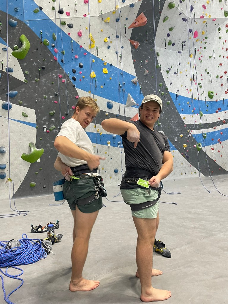
Step 1: Two max’s get their lead cert (Footage of Trevor lost)
First up on our list was lead climbing indoors. This required some basic top rope skills (should be able to climb around 5.11) and familiarity with lead gear like carabiners and belay devices. Although I had climbed top rope in the past, both Trevor and I were just about at the threshold for failing this class outright from the beginning. Climbing 5.11a was out of the question and we focused on getting in as much practice as we could: maybe 2 times a week. Passing the test required the execution of a 5.10a lead climb and lead belay, something we both felt would be doable only with a real in-person class. Given our limited weekend ability, the only time we could both attend this turned out to be one day after our trip to Oregon to climb Mt. Hood (another post on this webpage). So after our summit and red-eye flight back to LA, Trevor and I headed to the gym for our 5 hour lead class that next morning. It turned out to be a great time despite our possibly poor preparation. Our instructor and other climbing partners were super accommodating and our climbing skills were not that bad. Both of us could actually lead and lead belay each other on the easiest 5.10a of the gym by the end of the class. Both of us were monumentally terrified of the experience too, but we knew that some mock lead practice would probably solidify our skills enough to pass the indoor test within a few weeks. The only problem was our anchor and trad classes: they were planned for the following weekend and at the time seemed like a crazy way to proceed.
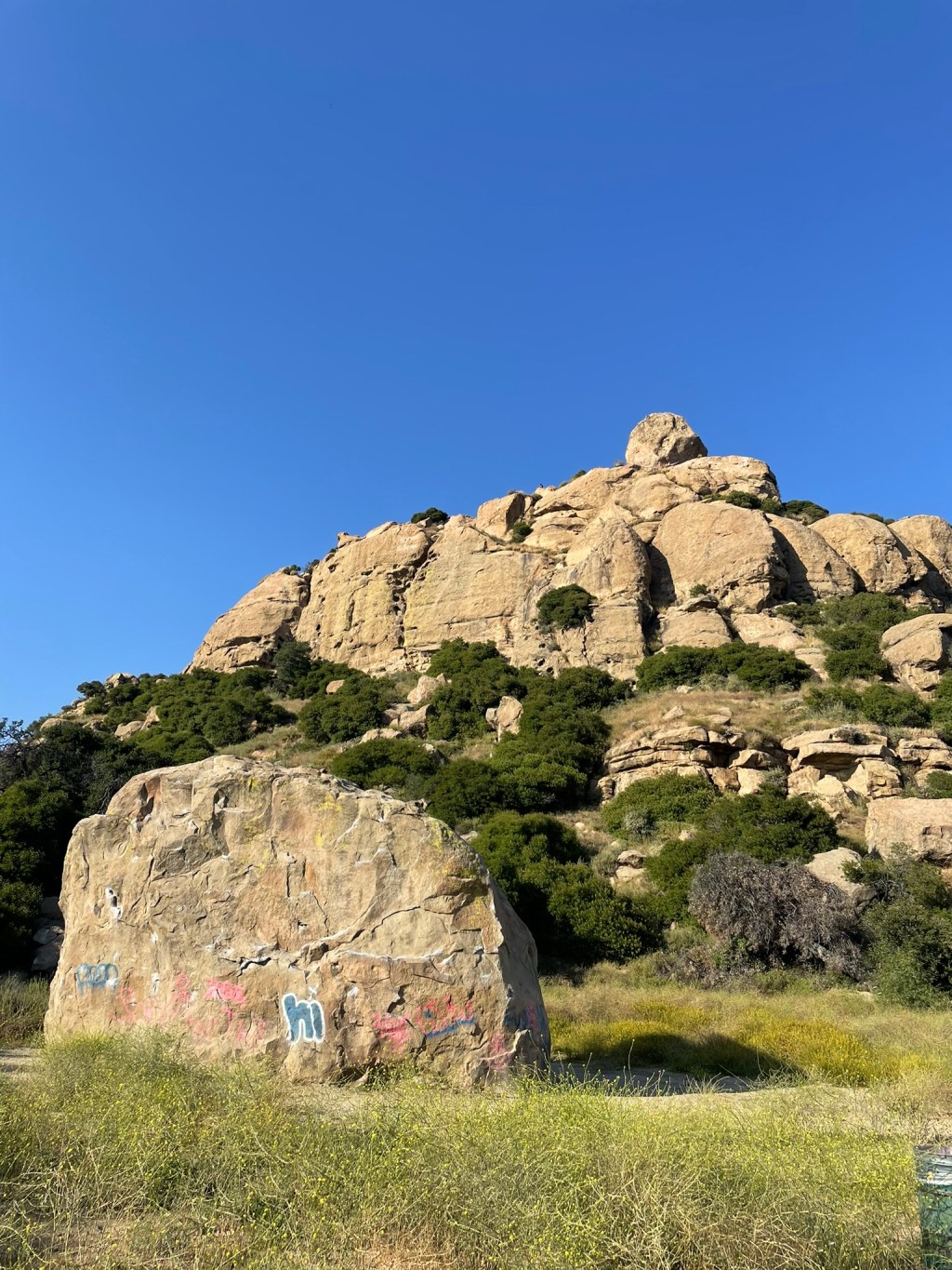
Stoney Point: training ground for anchor building and a historical climbing landmark
After an alarmingly quick week and two measly weekday climbing sessions, Trevor and I found ourselves driving to Stoney Point for our first of two full day courses on traditional climbing. Stoney Point is a pretty cool location to climb. Not because of the nearby traffic noises or distasteful graffiti, but because it was the birthplaces of American climbing to some degree. This group of sandstone rocks was ‘discovered’ in the 1930s by SoCal locals in the Sierra Club as a potential crag. A few decades later, legends like Royal Robbins and Yvon Chouinard got their start at Stoney Point along with many others who would go on to define California’s climbing history. I couldn’t help but start to feel some parallel’s to our own climbing journey. Even though we had no where near the same lifestyle or bravery it must have taken to develop new climbing techniques in unknown areas, our plan was still bold in its own way and was physically in the same place. Adding to this feeling was an excitement from the crazy amount of information learned in the first day. Traditional climbing revolved around the management of rope and anchors. Rope and anchors revolved around the understanding and implementation of knots. The functionality of these in union seemed endless and took some of the fear away from our lack of experience in the moment. Throughout the next day we continued to practice anchor and knot techniques, but with the addition of cams, nuts, and hexes to interface with rock cleanly. Ultimately the class aimed to convey a series of concepts that the govern traditional climbing system. Real rock is extremely diverse and requires similarly diverse ways to accommodate natural features for adequate protection. The goal in any case is to build an anchor that is ‘bomber’ (you trust with your life), belay from this anchor to start climbing, and continually place temporary gear to catch potential falls. Each pitch (a rope’s length) is finished with another anchor to get your partner up the same route while they clean all the gear which was just placed on the way up. Now that both you and I know how to climb, we are both ready for practice in consequential terrain (not legally binding).
Some rescue practice with SAANO adventures at stoney point
After our first weekend crash course, Trevor and I headed back outdoors to test our knowledge on some truly beginner terrain. While searching for some good trad routes near LA, I came across an large granite spire called Tahquitz rock right outside of San Jacinto. To my surprise, this rock shared Stoney Point’s incredible history and was also one of the first few crags that developed free climbing. Starting in 1936 with a route called “The Trough”, started a movement from the Sierra Club to push the boundaries of free climbing into grades like 5.8. Even the Yosemite decimal system used to define grades like 5.8 was initially developed at Tahquitz rock (and later popularized in Yosemite). In a fitting nature, The Trough was the route that stuck out to me the most. It’s route-finding was incredibly straightforward, it was only three pitches, and it was graded 5.4 (or 5.0 according to the Sierra Club’s initial grading). Similar to Stoney Point, climbing this route first also seemed like an homage to the history and pioneers of free climbing itself in the sense that we were truly starting from the bottom of what is possible.
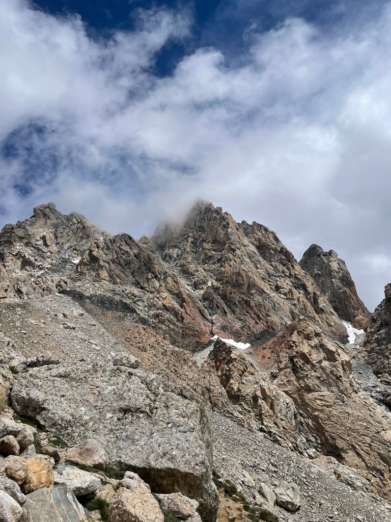
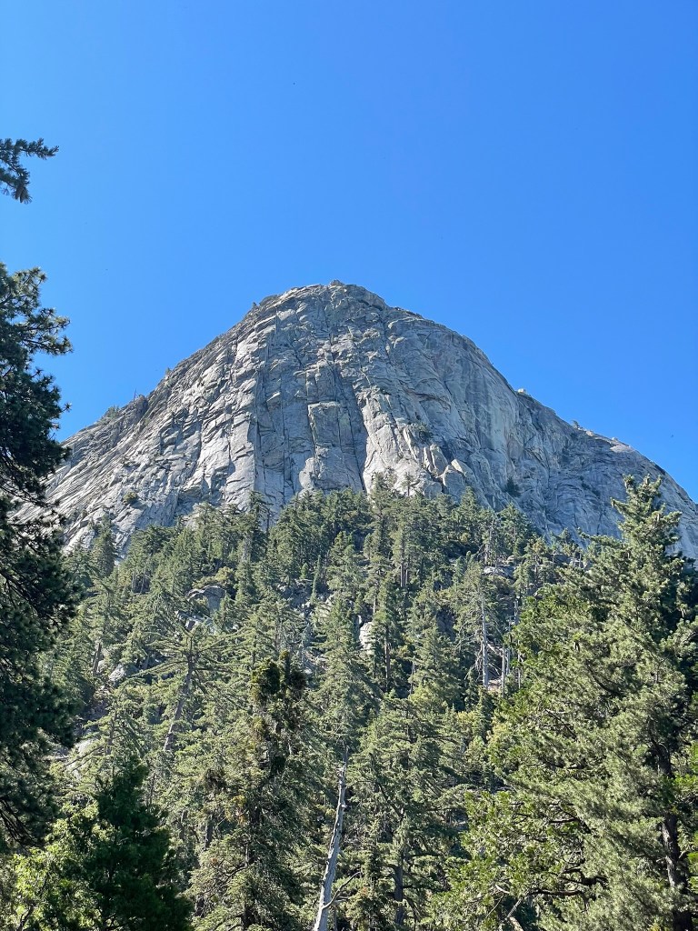
Tahquitz Rock: A beautiful granite spire and our multipitch training zone
Getting to Tahquitz is an easy ~2 hour drive from LA and starts near a town called Idyllwild planted right in the center of the valley behind San Jacinto. The landscape is beautiful and filled with giant redwood trees that sit below both Tahquitz and Suicide rock. Tahquitz is about 800 ft tall and looks like the head of a spear jutting up from the hillside. Below it sits a trailhead and a steep ~mile and a half hike up some sporty switchbacks. Trevor and I brought about 10 cams ranging from 0.4 – 3, a set of nuts, 10 alpine draws, and a handful of anchor building materials, some of which were purchased last minute at the shop in town. Once we got to the base of the route we decided to do a “practice pitch” in the approach just to make sure our systems were dialed. Shortly after, I began on the sharp end of the rope and made my way onto my first lead on gear for pitch 1. Climbing was relatively straightforward and mostly contained a series of gullies & chimneys to a small ledge. Getting to the ledge required a few steps on a friction slab, which was a little spooky. Otherwise it made for a great introduction and I quickly built a gear anchor on the ledge. Once Trevor joined me, it was high turn to lead and pitch 2 above us seemed like similar climbing. Unfortunately we didn’t bring any radios, so I sat at the belay station waiting for Trevor to make progress without knowing what he was about to encounter. Nothing went wrong, but it took about an hour or so for him to make it to the end of pitch 2 and make a slung anchor around a tree. I followed after and only came across one issue – a stuck #3 cam (RIP).
Lunch rock!Climbers next to the Trough
At the start of pitch 3, I was back again and feeling super psyched to lead. Below me was some crazy exposure for someone who had never climbed more than a rope’s length, but I felt like the climbing was well within my reach. Above me were some chimneys and dihedrals that were all pretty mild and I new my next anchor would be a slung tree. There was only one move in this pitch that spooked me. I placed some gear right before it, but still felt a little insecure stemming up a chimney with very few holds. It made we question whether we could climb any higher of a grade, but I still made it through without much of an issue. Getting to the top of the pitch was awesome and I practiced making the next anchor a comfortable hanging position. Technically I could have raced right to the peak, but figured I would take it easy and add in one more pitch. At this point Trevor came up and we both felt great, but also were out of water. I volunteered to quickly lead the next pitch to save some time and before I knew it we were at the peak. Since we were doing this in the first week of July, temps were in the 80s and we felt it. The descent was fairly not going to take us that long, but we were exhausted from the mental aspect of climbing and the relatively long period of time we were out there. Starting down the route was a small chimney and some friction slabs at a relatively low angle – probably 4th class terrain. We worked our way through with another group that had just summitted and then made our way back to the trail on the front side of the rock.
View from the P2 belayTrevor following up P3The peak of Tahquitz rock
At this point we were feeling super dehydrated and just wanted to make it back to the car. This made the descent fell way longer than it actually was and by the time we finally made it down we felt unbelievably thirsty. Despite this, we did actually make it through our first multipitch route unscathed and it was a blast. Climbing relatively easy terrain on stellar rock and with massive exposure below is such a great experience and made me want to come back for more routes right away. But first, we headed in town for some glorious Italian food to celebrate. I couldn’t help but drink as much water as I possibly could as we ate and chatted about the adventure of the day. Later that summer, we’d go for our alpine objective. It was the same grade, but would really test our new found skills and navigation in consequential terrain. Learning how to climb is really a career effort, starting it at Stoney Point and Tahquitz felt pretty special. After this first experience I am incredibly excited for that journey.
It’s hard to believe you can still ski in the early summer, but its even crazier to believe June can provide 5000 ft of quality snow. My first taste of summer skiing came from a trip to Mt. Hood, known for a variety of glaciers covering its 360 deg volcanic prominence in Northern Oregon. The mountain is part of the Cascade range, which spans from California to British Columbia and has dozens of volcanos reaching into the high alpine. Hood is an incredibly popular destination for both mountaineers and skiers due to its two south facing resorts and vicinity to Portland. Our plan was to make a quick weekend trip up to the mountain to summit and ski as much of its vertical as we could.
Mt. Hood summit viewed from the Palmer snowfield.
I flew out on a Friday morning directly from a work trip in Texas to Portland, Oregon to kick off the trip. My roommate Trevor met me there, having picked up some rental skis, crampons, and boots at a local mountaineering shop. Shortly after we blitzed to Hood River, a gem of a town next to the Columbia River Gorge and about an hour outside of the mountain. A mutual work friend of ours had bought a house with a fantastic view of the river and Mt. Adams nearby, which served as our brief headquarters before the early start on Saturday. The town itself was an outdoor sports mecca, with big mountain sports and wind surfing as the focal point. But for now, we only had time for a cruise into town for pizza to fuel up and carbo-load. We’d have just over an hour to snooze before nearly 5500 ft of elevation over just 3.5 miles of travel the next morning. As you would expect with a volcano, our route was a straight line from Timberline resort to the summit headwall and gradually increased in slope through the entire ascent. Weather and snowpack was forecasting well, so fitness and timing would be the crux of the summit.
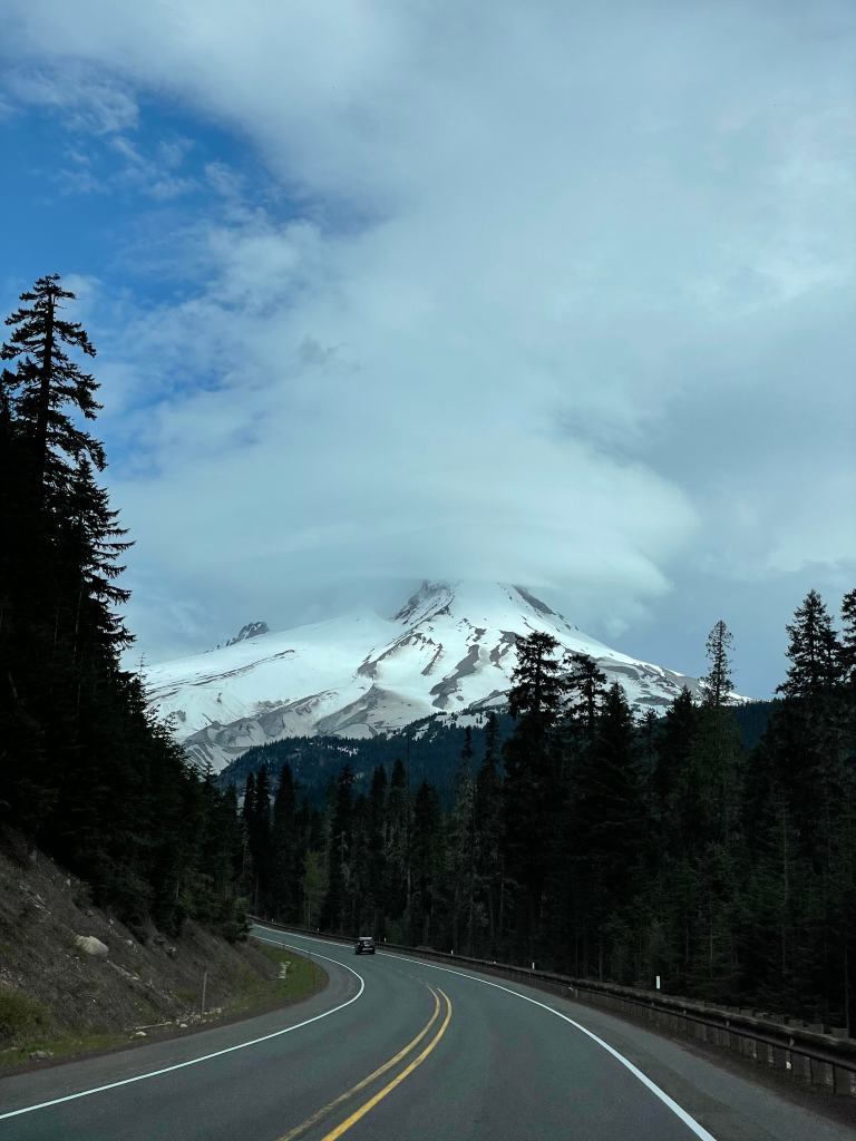
View while leaving Mt. Hood, with lenticular clouds engulfing the summit.
The Ascent
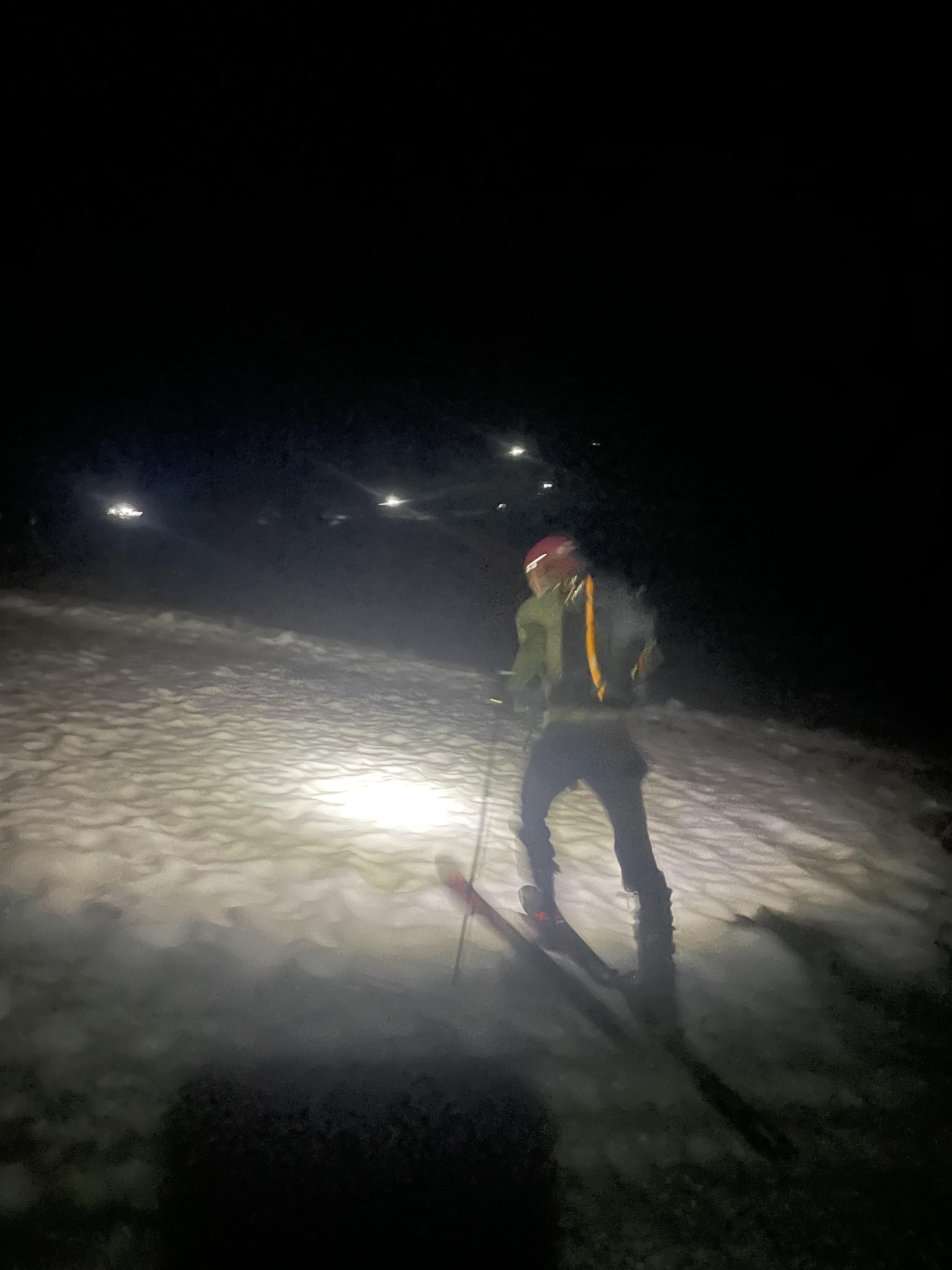
Alarms rang at midnight and we awoke in a haze before quickly grabbing some coffee. There was little left to pack, so we rushed in the car and headed about an hour south towards Mt. Hood’s Timberline resort. What surprised me most was the amount of snow on the way to the parking lot. Car height snow banks cover the shoulders of the road well before we arrived and the lot itself was carved into the base of the snowpack. As palpable as the snow was the crowds, which consisted of about a dozen other groups prepping for the climb at 1 am. It was clear we were going to be accompanied by many other parties that morning, but at least it served as a signal we had good conditions for a summit push. About 20 mins after arriving to the lot we headed off on our skins, also marking Trevor’s first uphill tour. Conditions were as expected: nearly bulletproof snow crust clearly from an midnight freeze. For the first 1500 ft or so we made great pace, especially for a beginner uphill skier. But after a while, the slope angle gradually increased, requiring some more careful foot placement and the use of our ski crampons. Eventually kick turns were necessary and Trevor felt reasonably uncomfortable moving forward on skis. Luckily we were nearly at the top of the Palmer lift, serving as an easy ledge for transitioning to boots and a good spot for stashing skis.
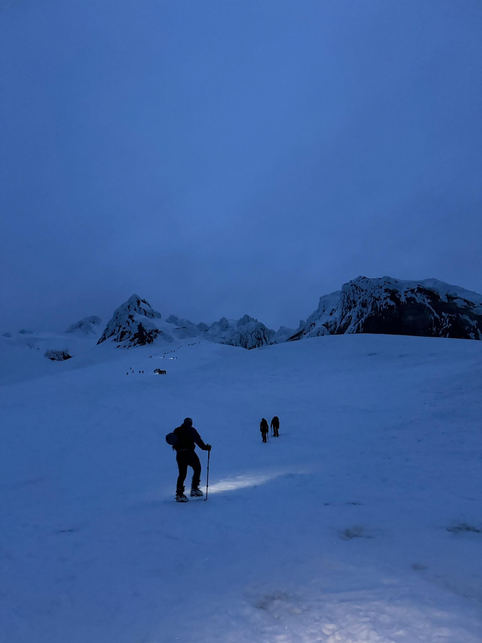
Despite being at the top of the Timberline resort, we still had nearly 3000 ft to the summit. About two-thirds of this vertical was a moderate boot pack up the Palmer snowfield to reach ‘Devil’s Kitchen’, a basin of volcanic fumaroles staged below the imposing summit headwall. Hiking this portion of the mountain was a slog. Trevor and I made relatively slow progress compared to the lower uphill touring. Several times we stopped for water and snacks, each time giving us some expectedly great energy boosts. It was during this portion of the hike that the first light of the morning illuminated the surrounding landscape. To our south was Mt. Jefferson and the Three Sisters: two sets of prominent volcanos along Mt. Hood’s same range. The view was incredible and helped us push to about 4000 ft at the basin of Devil’s Kitchen. There we brought out our ice axes and fueled up once more in preparation for the steep headwall climb. For many reasons, this was the most physically demanding and risky portion of the day. It was only about 6 am in the morning, but any warming from the sun could rapidly melt the rime ice coated pillars of Mt. Hood’s summit. While climbing this could manifest in heavy icefall, an objective hazard that could lead to serious consequences while climbing the steep snow. Adding to this risk, the several dozen other parties joining our ascent were raining more small chunks of ice and snow to the climbers below. Our best chance at success would be to push ourselves to climb quickly and reduce the duration of exposure as much as possible.
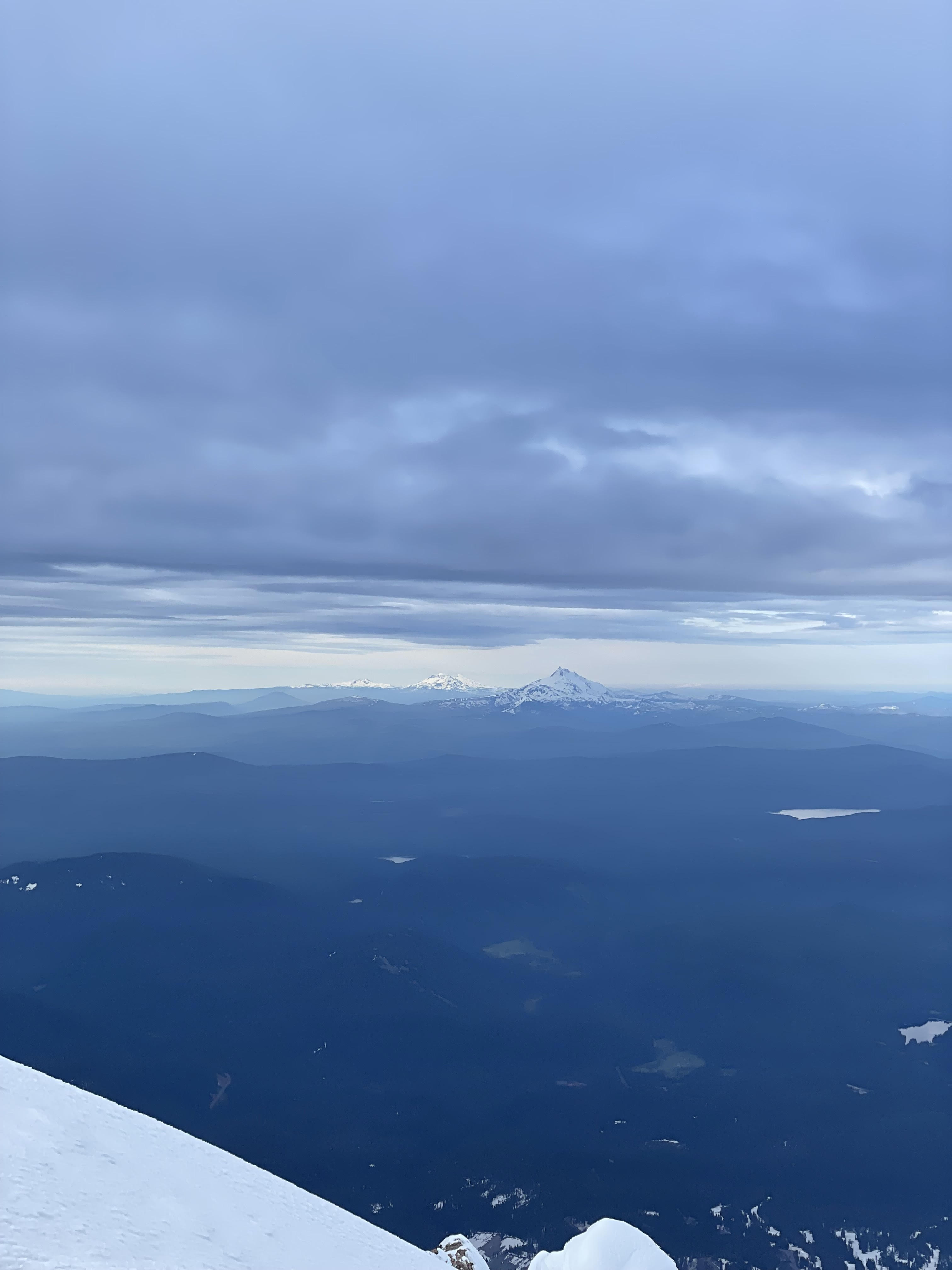
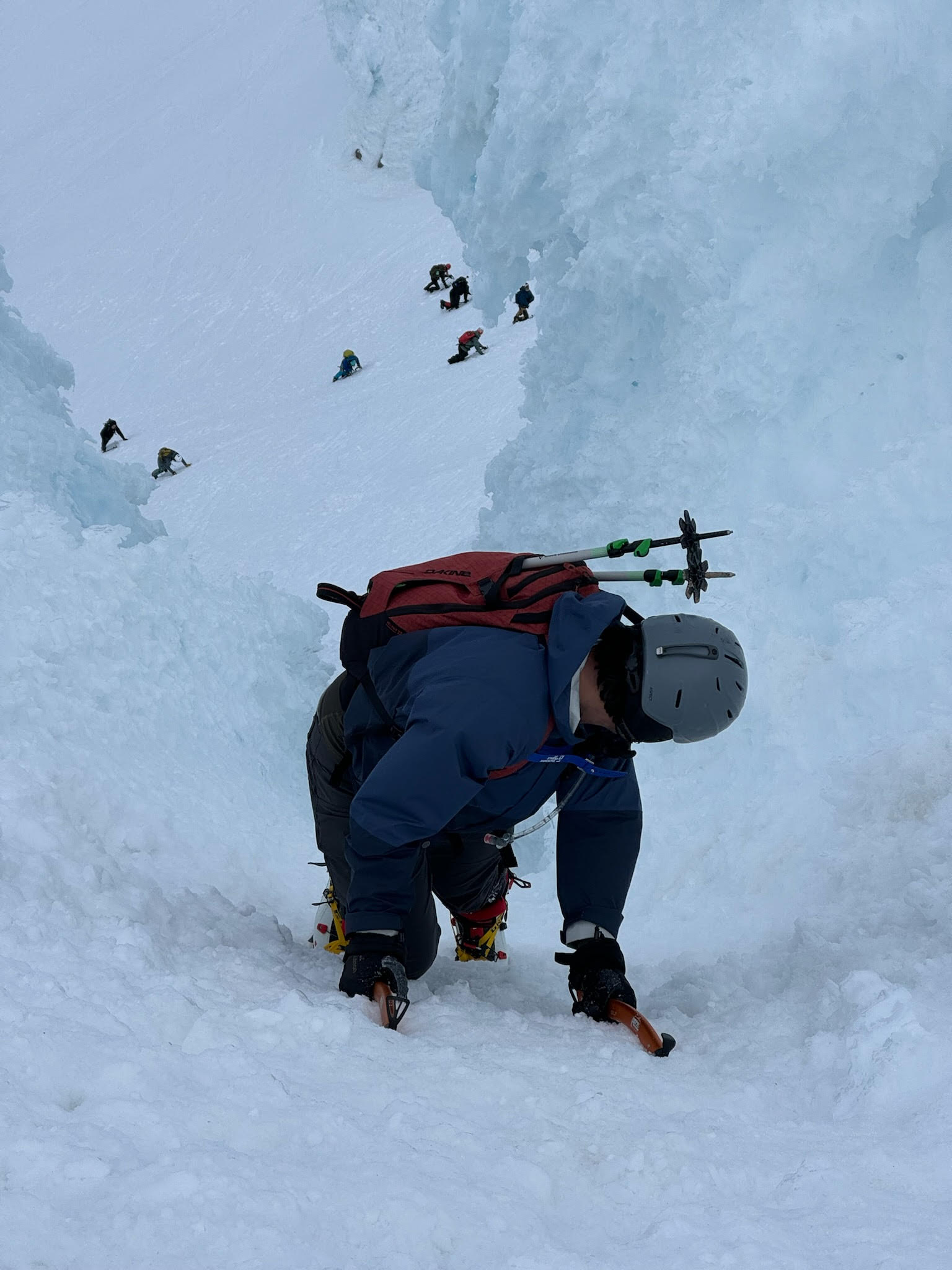
Climbing the ~40-50 deg headwall was incredibly demanding. Each step was equivalent to climbing a ladder with rungs spaced far apart, except this was the final 1000 ft of a 5500 ft day. Progress was incredibly slow, but we knew we couldn’t delay. Crowds made everything harder due to the falling ice and bottlenecked topout. We chose to climb the ‘Old Chute’, a wide open and steep clearing that lead up to a ridgeline near the summit. Another route called the ‘Pearly Gates’ was our original intention and was significantly less crowded, but had a large and open Bergschrund blocking its entrance like a moat before a castle. The concession of the Old Chute still worked out for us and we finally made it to the summit right before 8 am. The view was incredible and revealed more volcanos looming to the north in Washington. Below us was a sea of clouds, adding to the incredible prominence of Mt. Hood to the Oregon floor thousands of feet below. We could only spend a few minutes there due to the lingering sun warming, so we quickly made our way back towards the chute. Instead of the wide open clearing we climbed up, we chose to downclimb an adjacent rime ice tunnel to its right. This section was slightly less crowded but was incredibly steep. Progress was slow and intimidating, going any faster would create more risk but moving slow was tiring and tedious. Despite the increasing fatigue we continued consistently and eventually made it back to a rocky ledge below the headwall. I waited about 20 mins or so and fueled up before Trevor joined me, which made for a great feeling of relief having survived the most intense exposure of the mountain.
The Descent
Thankfully the remaining descent was much better than the headwall. A few hours of sun baking had made much of the hardpacked snow soft and easy for travel. The first 2000 ft or so we were able to take off our crampons and glissade down the mountain. We passed another several dozen parties still making their way up while craving on our asses down the gradual slope. Finally we found our stashed skis near the top of the now active Palmer lift. I was feeling incredibly tired, but also had a rush of emotions having only 2000 ft to go on skis. Turns felt unbelievably difficult and I had to stop many times while I made my way through the resort. The whole time I found it crazy to believe just how much vertical gain we had made in just a short distance. Nearly three full sized ski lifts spanned less than half of the mountain’s alpine terrain. Nearing the bottom of these lifts was our car waiting in the lot and making it there finally was an amazing feeling. We made it through the climb with little hiccups and felt like we had really pushed ourselves physically. As we took off our gear, the mountain was lit up well in the now afternoon light and we could see gigantic lenticular clouds stuck at the peak above. The view was even better as we drove back, ironically being the first time we saw the peak during daylight. The next stop was the airport back to LA, marking the end of our brief Oregon vacation. Mt. Hood was an incredible climb and one that I will definitely mark for a repeat, maybe even to ski from the summit!
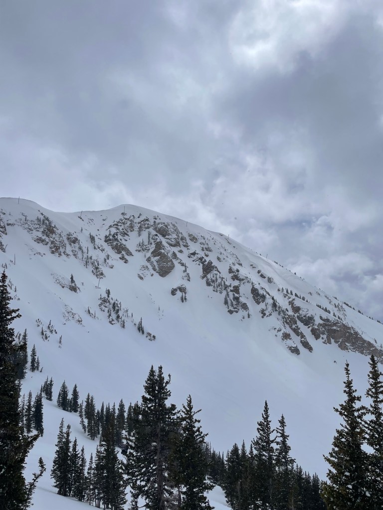
After a great month of spring corn skiing in April, May of 2024 brought out one more sneaky storm to fill out Utah’s backcountry terrain. Luckily for me, I had already planned a visit to Salt Lake City for a long weekend with the hope of exploring what the Wasatch and Ogden backcountry had to offer. Joining me on the trip was Ian Hokaj and Devin McCabe, the three of us making a group of inexperienced backcountry ski newbs. We had the goal of getting some ski tour volume under our belt while also making the most of the weekend’s great weather and recent snowfall. Despite high warming & generally low tide making for pretty tame avalanche conditions, the ~18″ of snow that fell earlier in the week made for some high consequence wind and storm slabs in the high apline. This manifested in a tragic accident, with three skiers triggering a slide on Lone Peak. All three members were buried and two did not survive, making for an incredibly difficult week for the utah ski community. This morbid atmosphere made us acutely aware of the ‘wicked’ nature of winter backcountry travel and set us on a mission to make the most out of a deliberately conservative hit list.
View of Ben Lomond from Cutler Ridge, many wet slides had been triggered in the week prior.
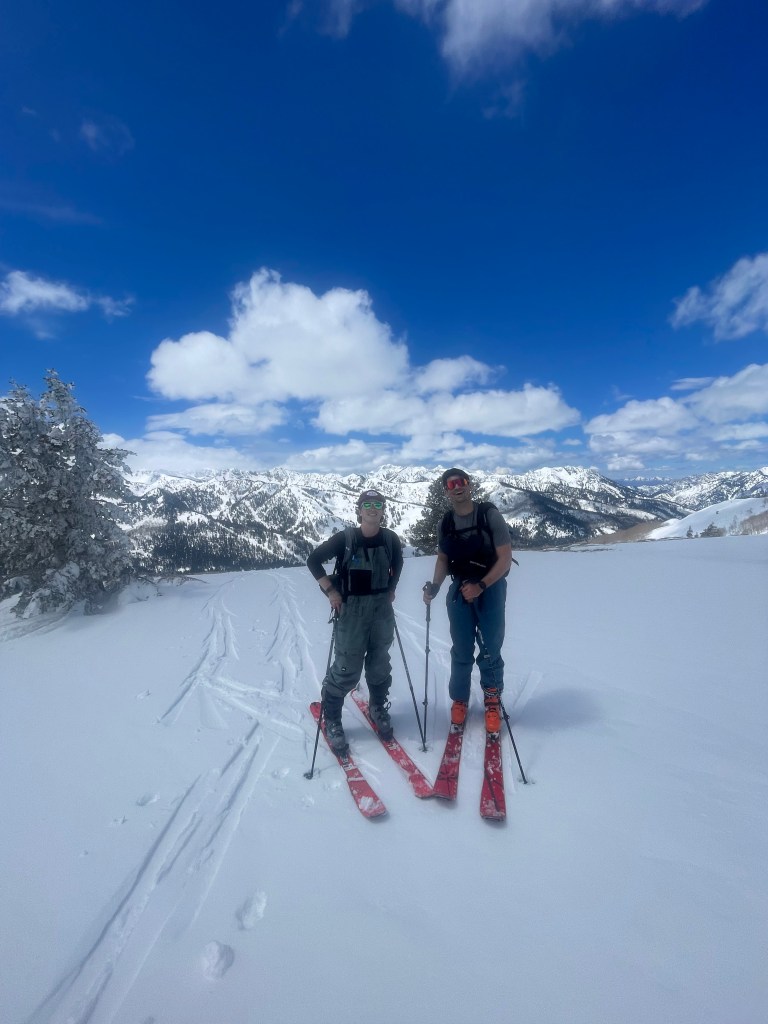
As soon as we set foot in Utah, stoke for a great weekend flooded back in. Friday was our first full day and we chose to tour some classic & simple terrain in the cottonwoods. First up was USA bowl across from Solitude and Brighton, which was a repeat for Ian and a pretty tame option in most conditions. Devin also had the privilege of making this his first tour with alpine touring bindings as opposed to bipedal locomotion in ‘alpine’ hokkas. A short hour and a half later we found ourselves on the top of the bowl, probably wishing we were there slightly earlier in the morning. After a quick carb replenishment (one Coors lite), we made a dozen turns in some dense spring snow and then quickly made our way back to the car. The day’s skiing was more about getting our bearings together and not getting in an avalanche, so we brushed off the snow as a one-off and headed to Alta across the canyon for another lap. This time our tour was joined by a few other locals scattered around and felt like we were getting in the swing of things. Off in the distance was an enticing view of main chute on Mt. Baldy, but we held ourselves together and focused just getting to the top of the lift. A speedy carb replenishment later had us ready for the descent and this time we were pleasantly surprised by some less-wet turns for the first half of the run. Overall we were feeling good and ready to scope out some new terrain for the rest of the weekend.
Ian and Devin at the top of USA bowlView of Mt. Baldy from the Collin’s chair
Friday’s definitive success put us in the mood for a night out in the town, but we still had our minds set on adventuring out to a new area come Saturday morning. In particular, Ian scoped out a mellow ridge hike on Ben Lomond Mountain lining Ogden Valley. Despite a hilariously late start, we knew we could still get a decent hike in a ridge that was all low angle and most likely void of any other kooks like us. Our kit that day consisted of cutoff jeans, Hawaiian shirts, and a speaker that was unreasonably large for some reason. Despite the ridiculousness of the day & gear, our hike was a complete blast. The terrain felt very safe, our speaker was tastefully motivating, and our carbs were nearing replenishment. All of us felt great in terms of pace too, which made for a super efficient tour to few hundred feet above the treeline. In front of us were some spectacular headwalls & spicy chutes far in the distance. Huge wet slides lined this steeper area and we new from the region’s guidebook that this area has a not-so-fun history of burials. Having little time and no desire to test those waters, we enjoyed an incredibly clear day on the top of Cutler Ridge. Skiing down was not to shabby either and soon enough we found our way back to the initial bushwhack and trailhead. To cap off the energy from the day, we took a dip in surprisingly refreshing Pineview Reservoir & a visit to the “oldest bar west of the Mississippi” name The Shooting Star Saloon. Although turns out there could not compare to resort skiing in any sense,
“Benny and the Jorts” – Ian and I skining up Cutler Ridge on Ben Lomond
With one more day of skiing ahead of us, we spent Saturday night feverishly deliberating on what to do next. In front of us was a typical guidebook for the greater Wasatch range, but also a skinny blue book called the “Chuting Gallery”. Of course none of the lines within the gallery’s list were safe, within our capabilities, or good skiing with the current conditions, but we were feeling good and I had my eyes glued on the Wolverine Cirque chutes. These lines were clearly a bad idea to ski, but were also positioned right behind Brighton resort and perfectly close to the super mellow Wolverine Bowl. Our debate session lasted a tad longer and we finalized on this region with an early start for the next morning. After all, Sunday also happened to be nearly Solitude’s closing day, which would be a no-brainer for an end to the weekend post tour. So come morning, we began skinning up the Millie lift line and towards Mt. Wolverine. The first half of the tour was straightforward and make for a quick pace. Soon we arrived at the top of the lift and began to stare at the Millie summit boot pack – our first real avalanche risk of the trip. Since Ian & Devin had never taken an AIARE course (oof), we decided to practice a rescue on some flat ground. I buried my pack, made some fake dig sites, and then let both Ian & Devin go find & un-dig it on their own. Thankfully it went pretty smoothly and set a good tone for the rest of the bookpack to the summit.
Setting a bootpack up to the summit of Mt. Millicent
Climbing Mt. Millie is super easy when there is a boot pack set and lifts are running, but something eerie persists when the slope is clean and no one else is around. While we charged ahead, both Ian & Devin had some second thoughts about the exposure of the steep slope. Realistically the snowpack was consolidated, cold, and at low risk of sliding given our position at the apex of the ridgeline. But that didn’t stop the us from feeling like we were on the edge, as most steep ridges tend to do. It didn’t take long until we finished out the hike and stood atop Mt. Millicent with a fantastic view of Mt. Wolverine, Patsey Marley, and the spectacular terrain on all sides of the cirque between them. Immediately it was clear from the hike we just came from and the school bus sizes cornices overhanging steep and narrow chutes that the cirque was not in for skiing. Instead we’d take the mellow 25 ish deg bowl to the north off Wolverine’s peak. To get there, we made a relatively each skin across the ridgeline and onto our 2nd summit of the day. From Mt. Wolverine, the entirety of Little Cottonwood Canyon is on display and it makes for a spectacular viewing point. We stood atop feeling accomplished and excited for the upcoming descent, having made a clear progression in the complexity of terrain we just crossed.
Ian walking towards Mt. Wolverine with the cirque in full viewView of LIttle Cottonwood Canyon from the summit of Mt. Wolverine
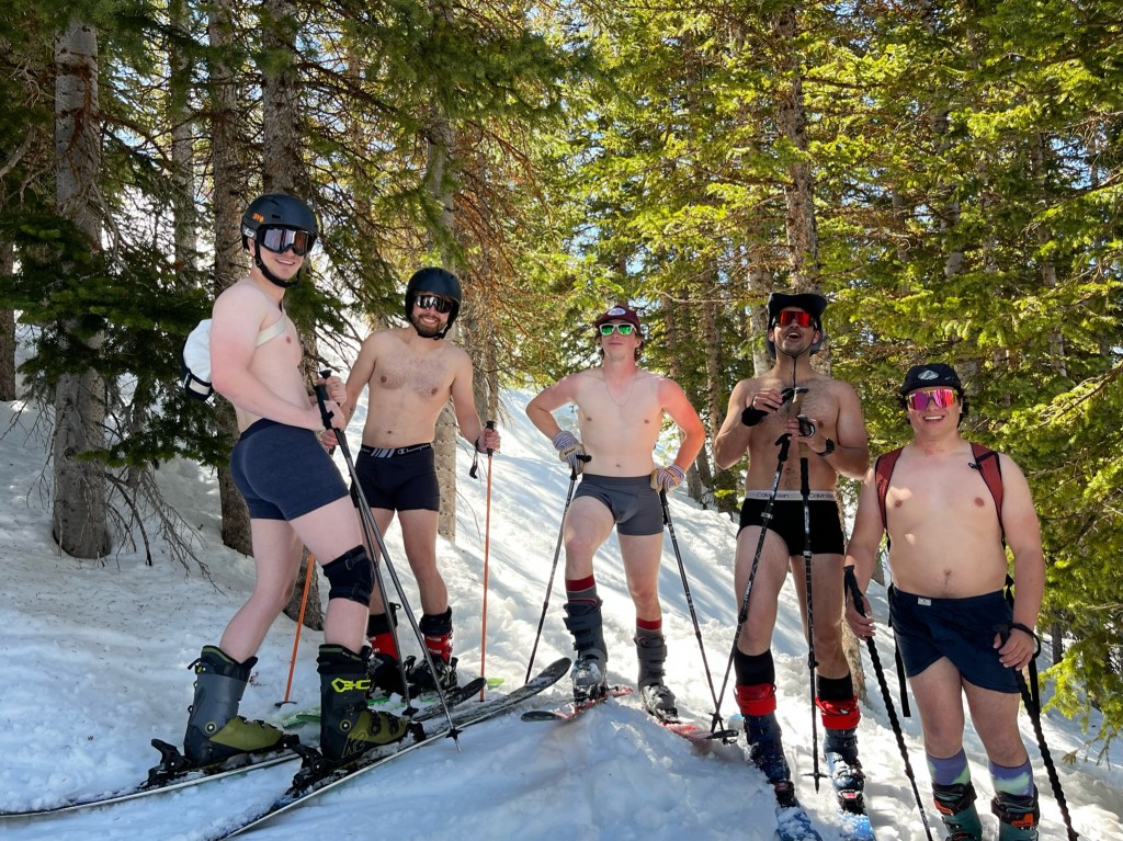
Skiing down was a bit lackluster. Even though we had the whole mountain to ourselves, the snow had soaked up the sun and we were struggling to carry speed in the wet conditions of late spring. After the main bowl, we traversed through a lake plateau and over a small ridge to get back to the resort. Skiing out into Brighton felt amazing and we were all immensely tired from the big morning. While getting to the parking lot, we shared a few beers and then got ready to meet up with some local friends for some victory laps at Solitude closing day. Similar to the day before, we dawned our hand cut jorts and ridiculous Hawaiian T shirts for party lap after party lap in bounds. Ending the day with an underwear lap for good measure, we found our way back to the lodge and celebrated a great weekend of mediocre spring touring as our introduction to the Wasatch.